Loch Tulla

West Highland Way: Days 4-5, Inverarnan to Glencoe

This post was originally published on All Women All Trails, a community of adventurous women sharing their experiences in the outdoors.

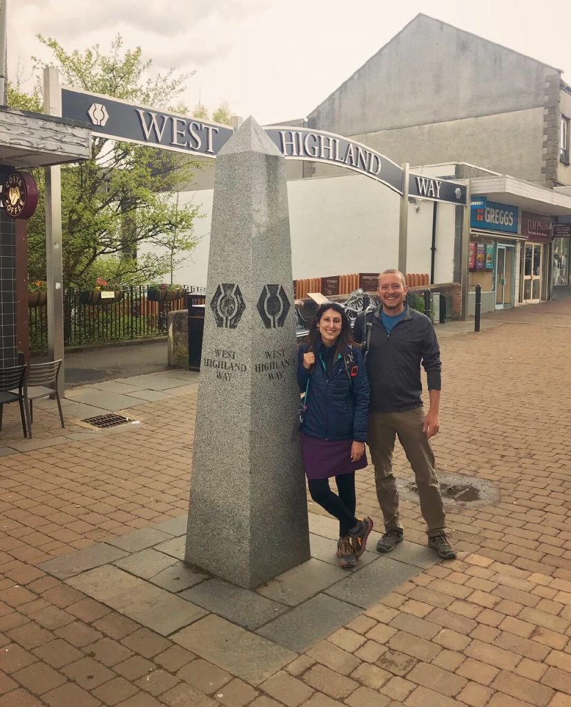
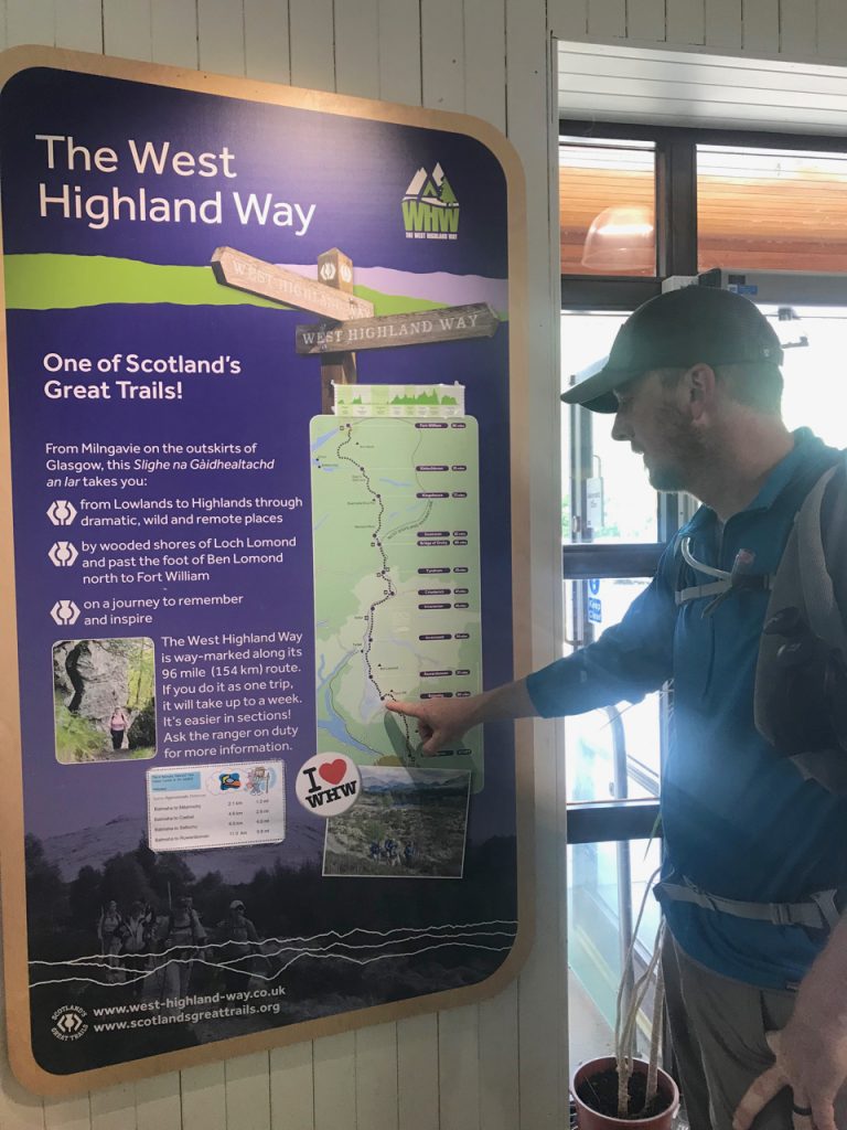
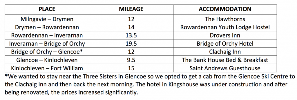
Day 4: Inverarnan to Bridge of Orchy, 20 miles

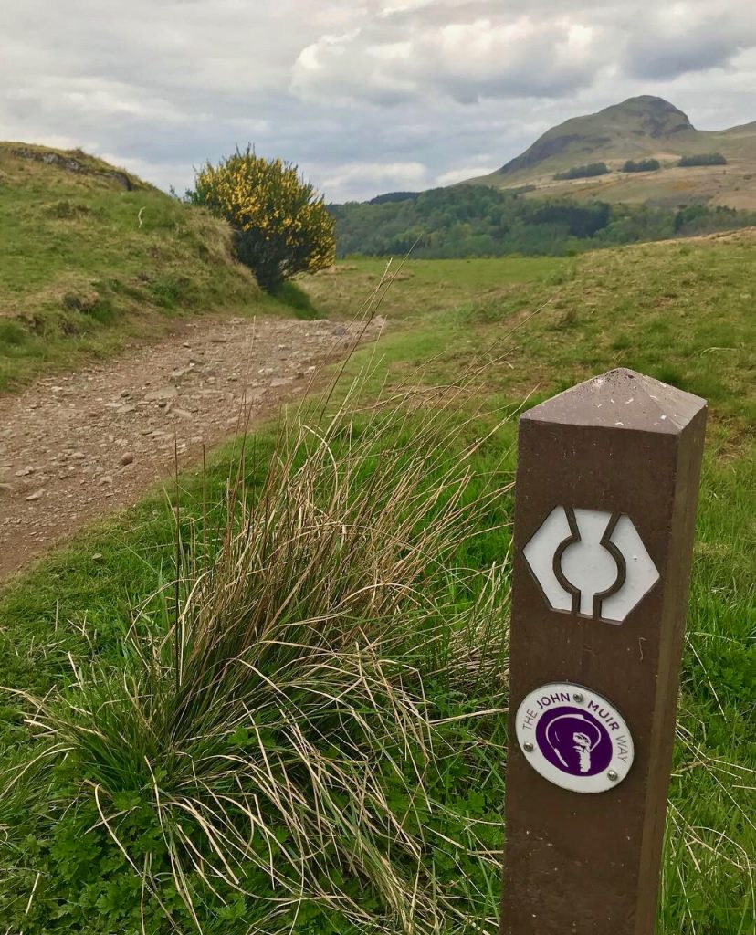
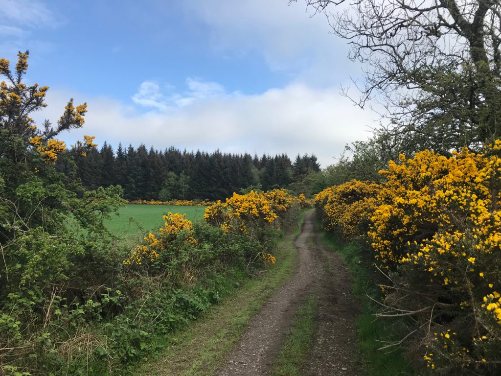
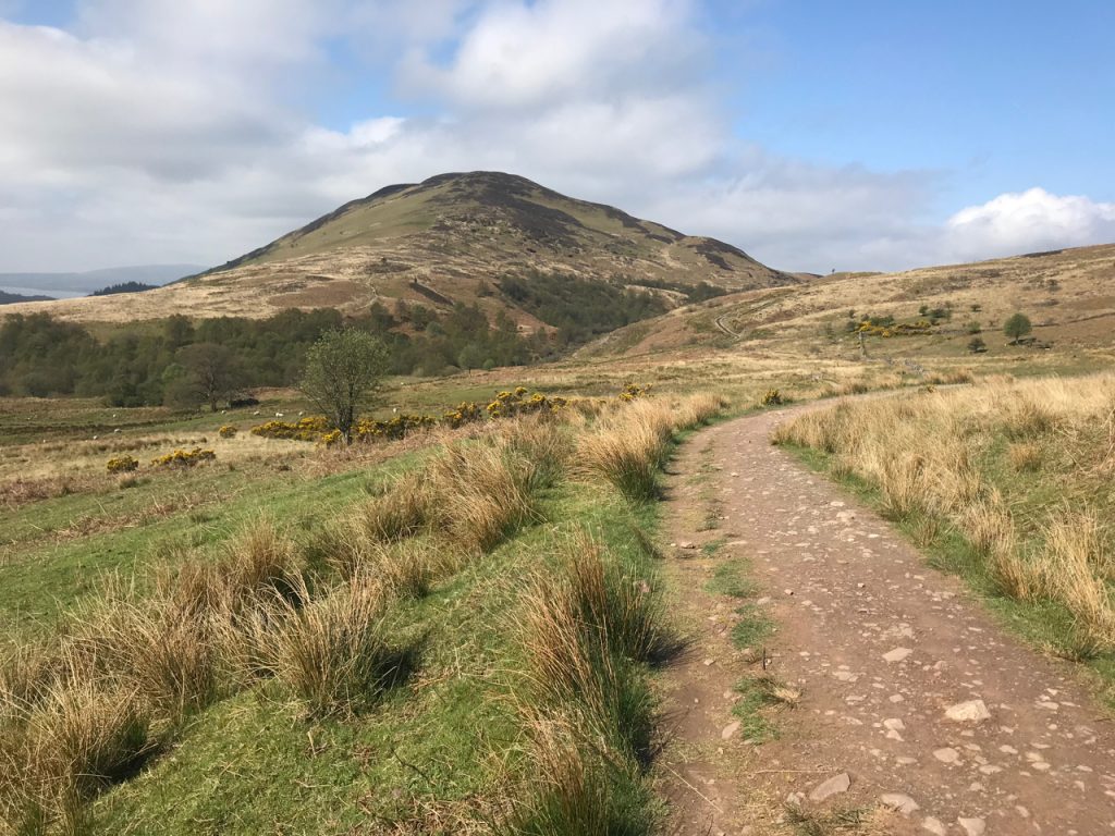
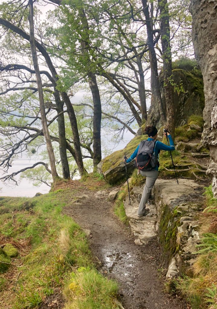
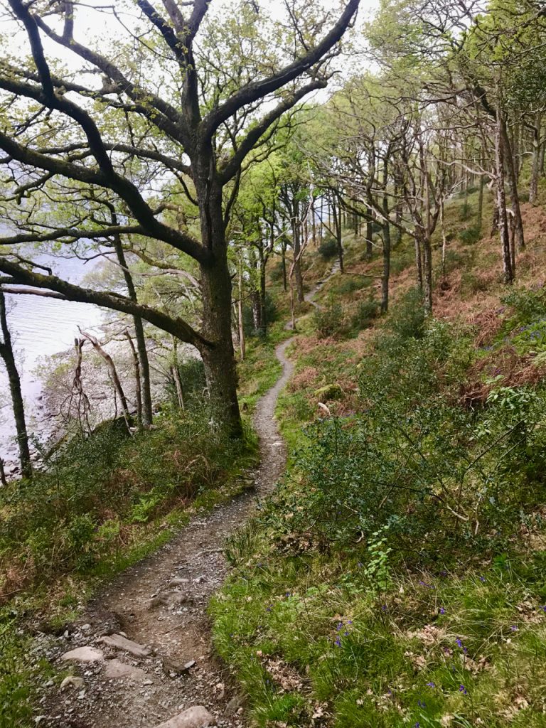
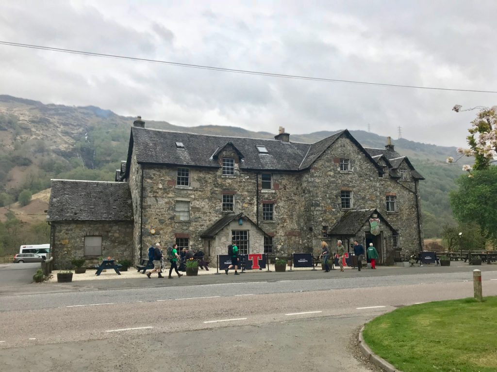
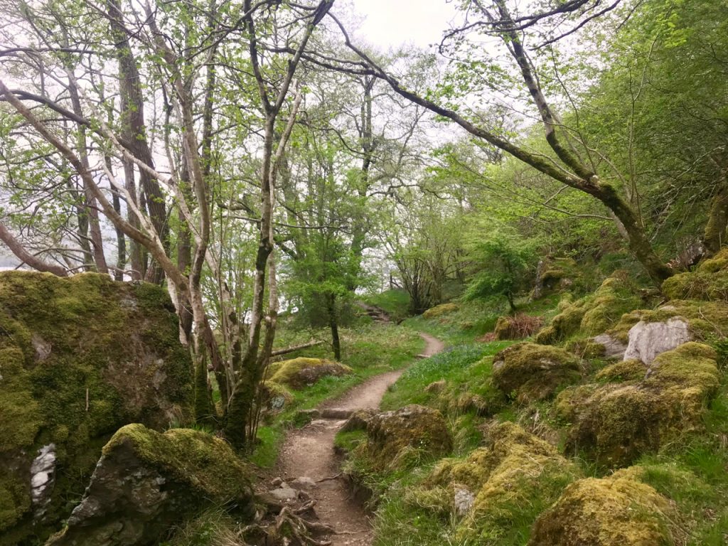
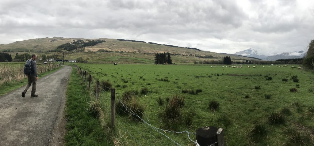
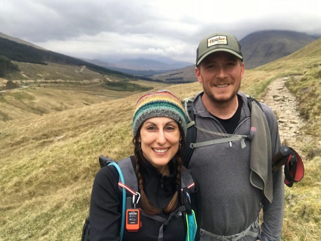
Today was the toughest day so far because it had the highest mileage. We left the Drovers Inn and had a fairly even walk along a dirt road that soon began to go up, up, and up. We passed sheep pastures and flowing rivers as we ascended up the West Highland Way.

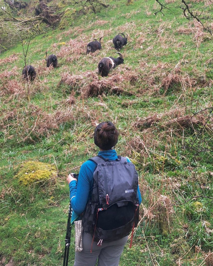
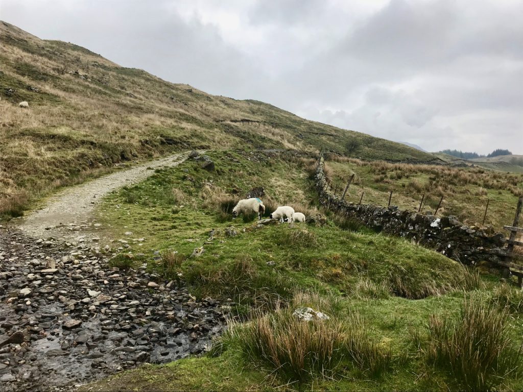
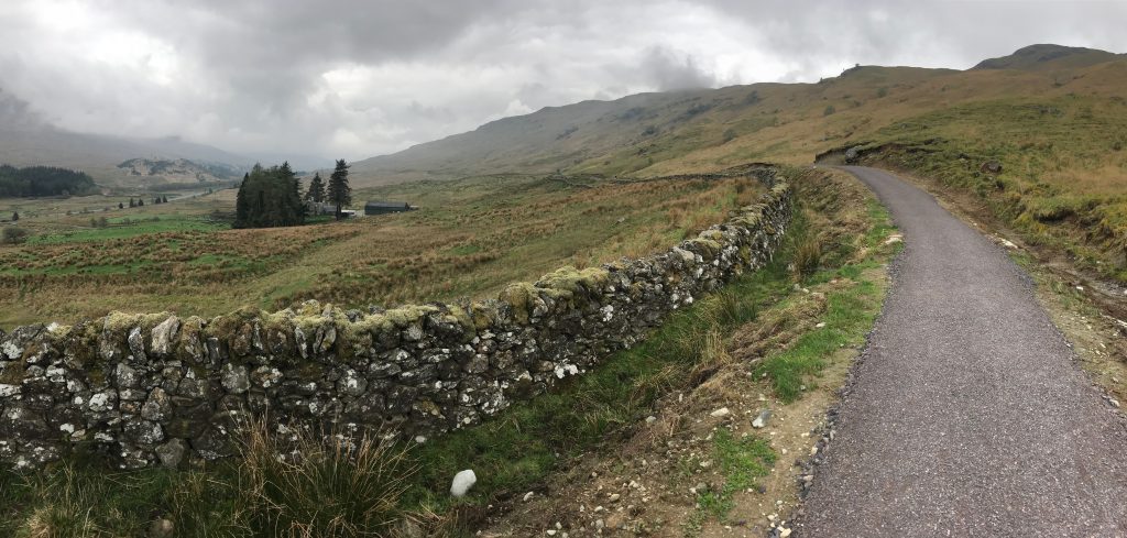
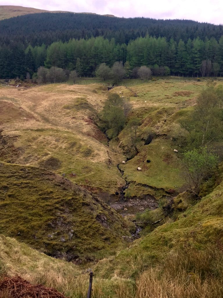
At one point, the trail opened into the most spectacular view as we walked through an old impressive sheep farm with ancient stone walls that went on for miles. The view was expansive and there were sheep grazing all over the hills with some munching grass with their lambs right next to the trail. Along the path were some puddles that must be constantly refilled with recurrent rains because they were full of tadpoles!

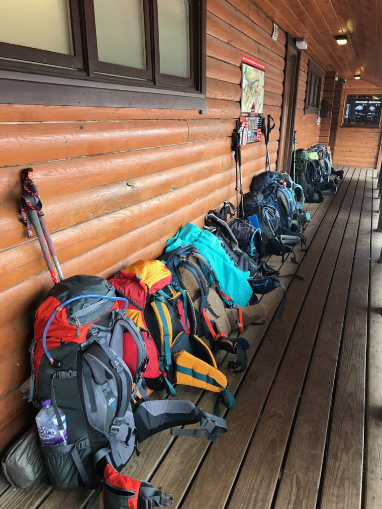
We didn’t see a soul the entire morning until we reached the turnoff for Crianlarich at the 6 mile mark. Several backpackers came down the trail, and it seems like another popular village where walkers stay. At the junction there was a bench where we sat eating snacks, staring at the hill we were about to climb. They have Snickers protein bars here and I’m so mad we don’t have them in the U.S. Talk about a missed opportunity for Mars with the way hikers consume Snickers on our long trails. Also, I’m taking shortbread on all my future hikes. It’s an awesome snack. We talked with a Scot who had hiked the WHW 13 years ago and had two adorable dogs with him. He said it’s pretty much the same with a few improvements.

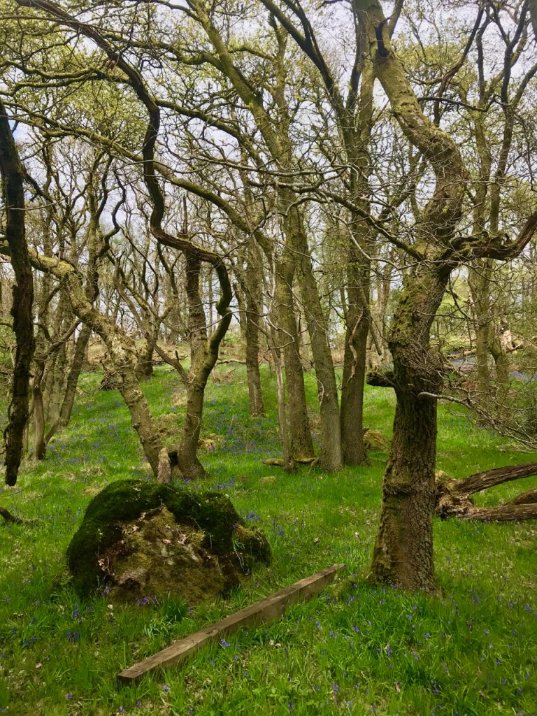
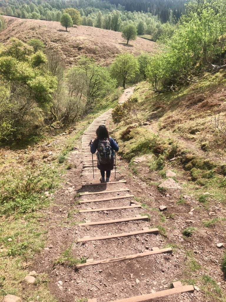
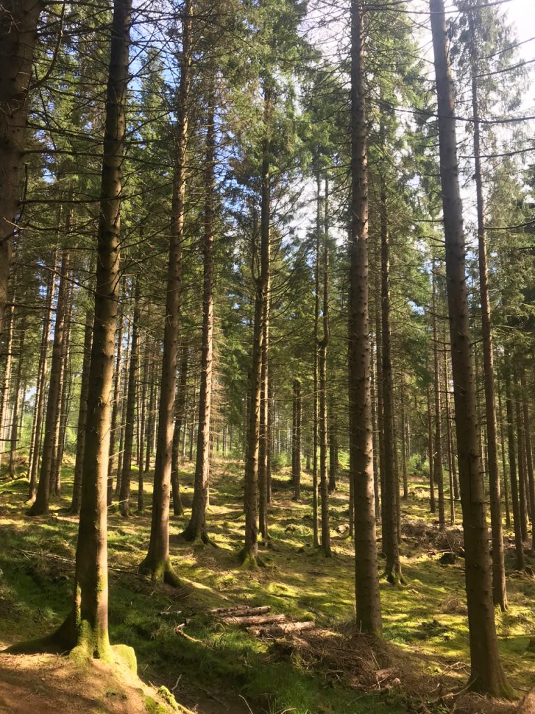
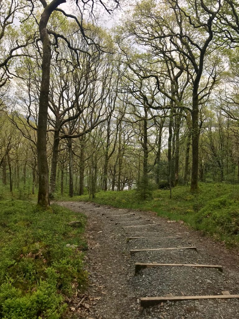
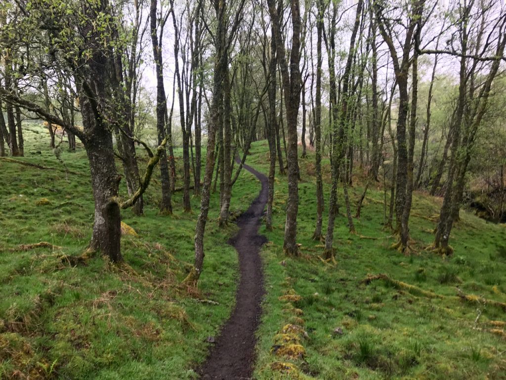
There was another significant climb out of Crianlarich that took us into a shadowy pine forest. The path became red with needles that were soft beneath our feet, a welcome change from the cobbles.

The views began to get more dynamic. This was such an interesting section because it led us across a river through another huge sheep farm where a farmer and his sheep dog were moving a ewe and some lambs. He was whistling commands and I immediately felt like I’d been transported into a James Herriot story.

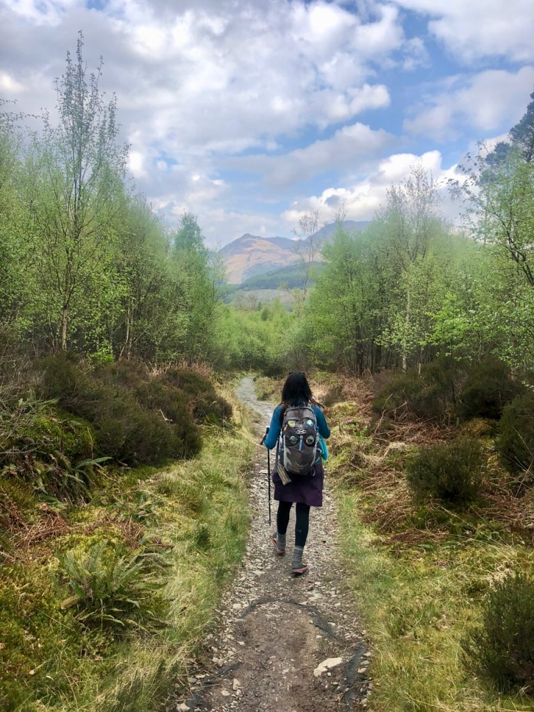
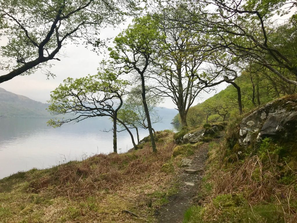
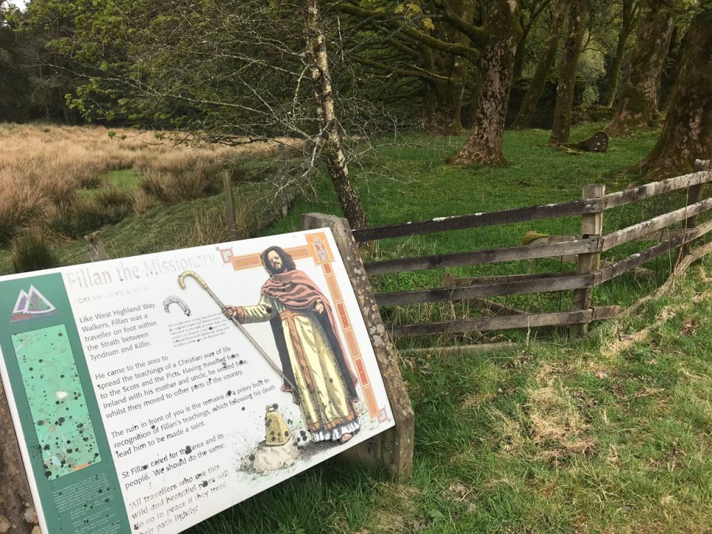
At this point in the day we noticed that the haze of the morning had lifted and the views had cleared, giving us a nice vista of the mountains ahead. The first snow came into view, just barely hanging on the peaks with the warmer weather. We continued to pass cows, sheep, and small camping accommodations that looked like hobbit houses. There was also some interesting history along the way, like the priory of St. Fillian.

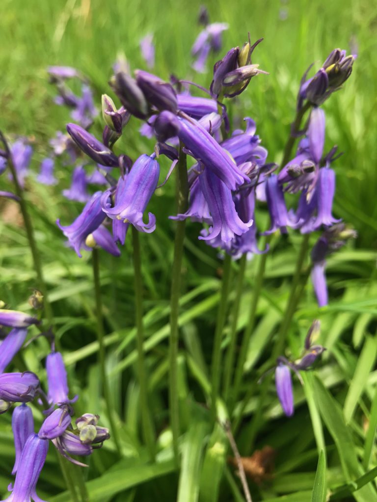
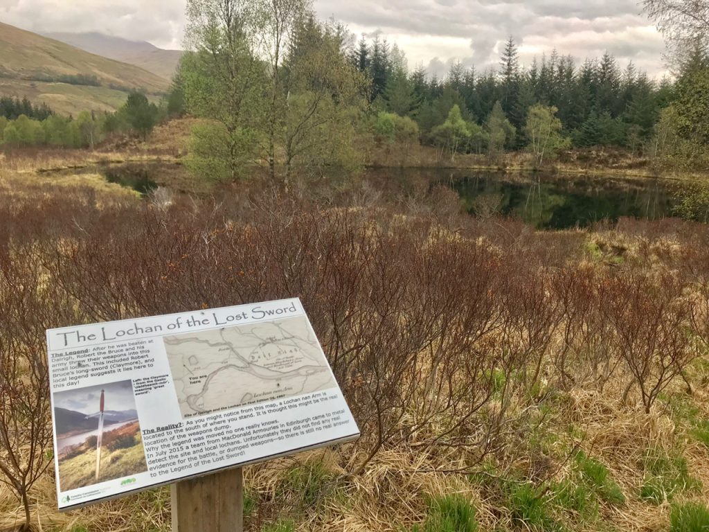
We entered the Tyndrum Woods, a natural preserved area known for birds and wildflowers. It was quite a pretty moorland and we past the lochan of the lost sword. Such a cool story!

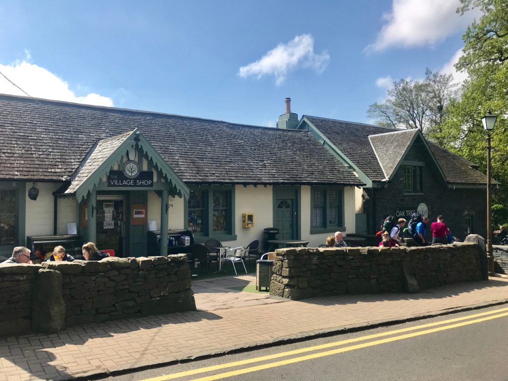
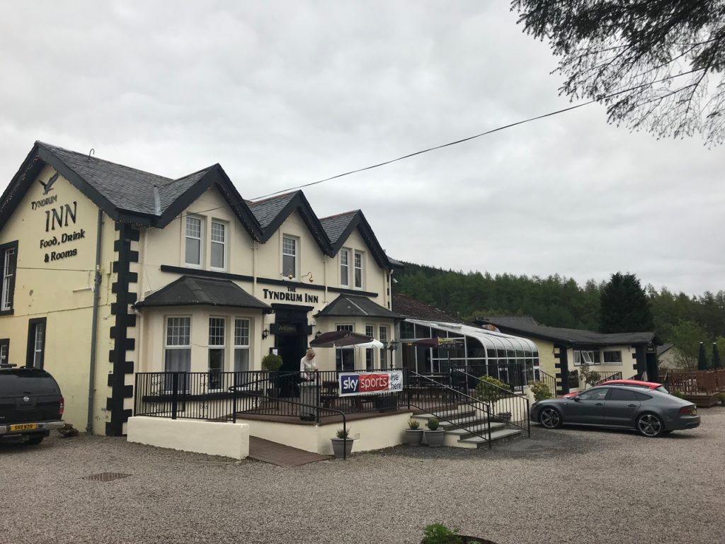
As we entered Tyndrum, we headed straight for the Tyndrum Inn for a pint and some burgers, which were delicious. They also had free WiFi and we were able to baby our feet a bit by adding blister gels and bandages. The Green Welly is next door and resembles a truck stop with a cafe and a couple of touristy gift shops.

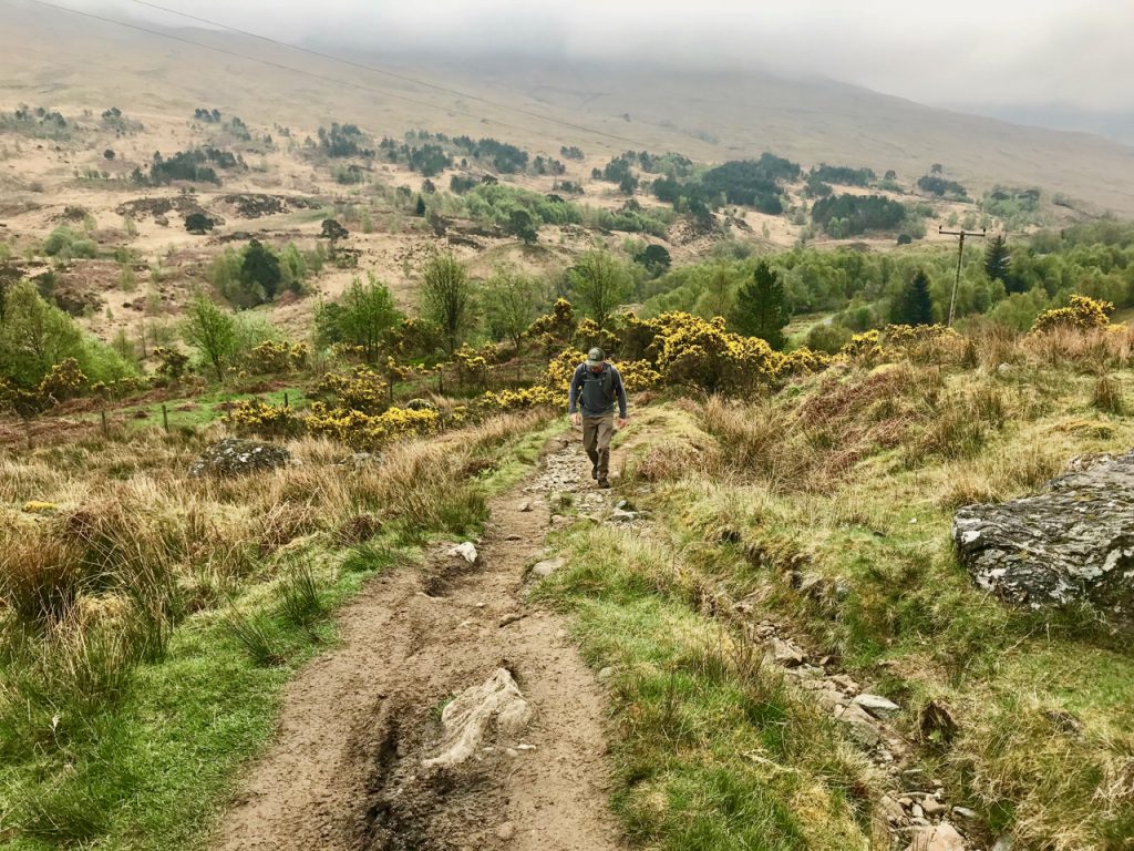
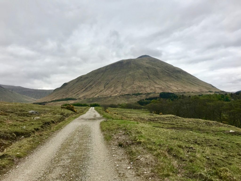
The next 7 miles of trail were an old military road that went beside the incredible hills looming before us. The views were stunning. More sheep and a few Highland cows had left some serious patties along the road. As much as I adored this section of the WHW, it was also the hardest on my feet. The stony path nearly broke me. We stopped a couple of times and rested, ate some candy (Cadbury!), and continued around all the twists and turns that led to even more spectacular vistas. A couple of military planes flew quite low above us and it was really cool to get a good look at them.

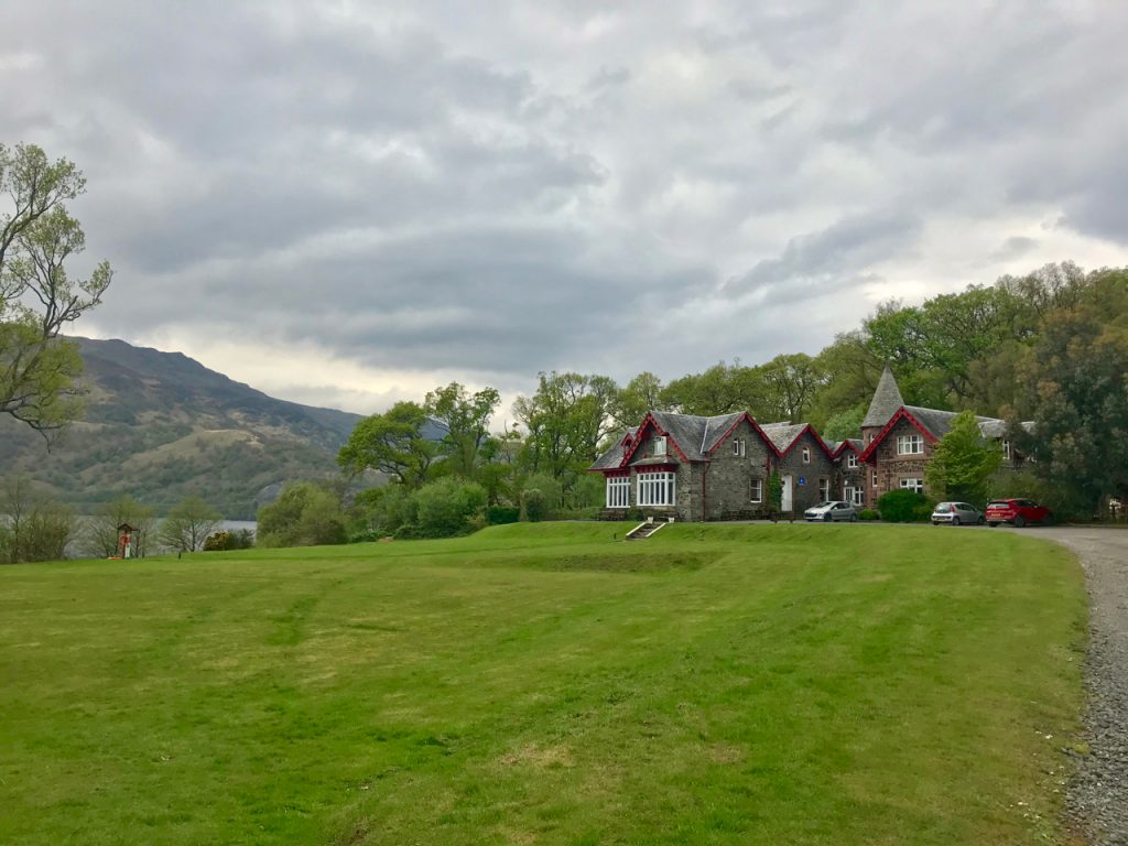
When we finally saw the Bridge of Orchy Hotel in the distance, I nearly cried with relief.

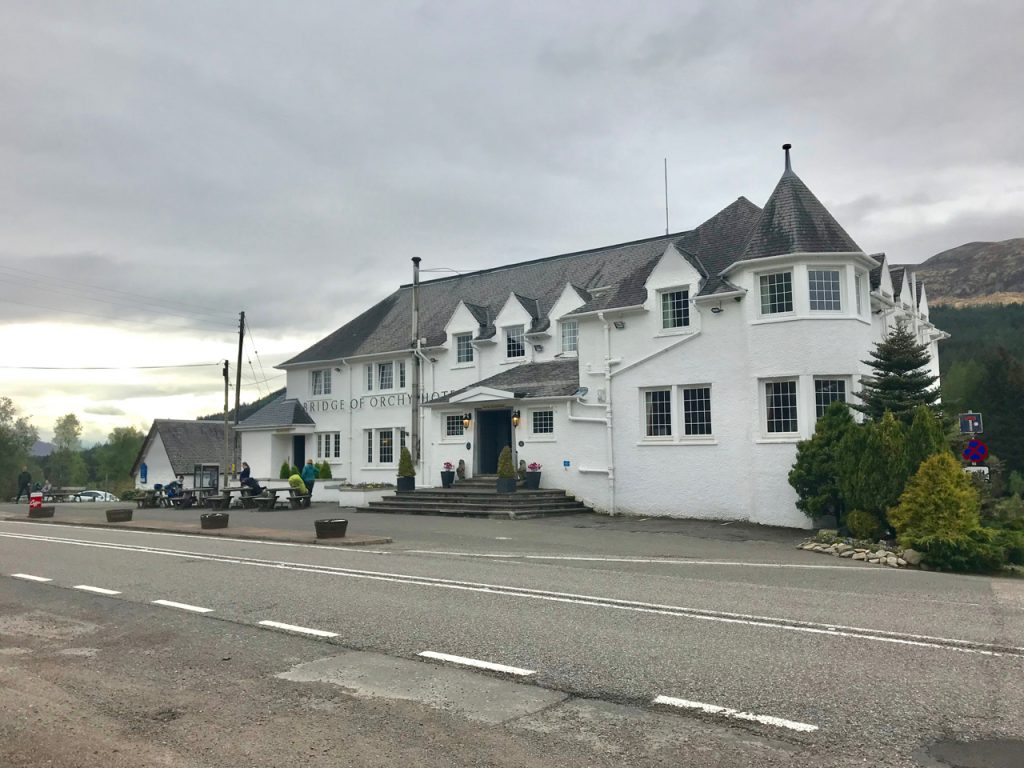
It’s a lovely hotel, and is worth every expensive penny we paid to stay there. The room is SO NICE after the dump we stayed in last night. The food in the restaurant was delicious, there are attentions to detail that I appreciate SO MUCH after staying in a hostel and the Drovers. There are lots of outlets in convenient places, a kettle with tea and snacks, a very clean, bright bathroom with a toilet seat that doesn’t slide halfway off when you sit on it, an entire vestibule where we can set all our clothes and packs that is outside of the room (!!!), gorgeous views from our little balcony, a packed lunch for the next day, etc. I can’t recommend this place enough. There is no WiFi in our room, but we’ve been reading, playing games, and I’ve been writing at night.

My feet are killing me. I have an awful rash that must be exercise induced vasculitis. This never happens to be on trails at home, but it did happen a few years ago when I walked on pavement from Boston to Maine with EverWalk. I can’t figure this out. I have a hunch that it has to do with walking on hard surfaces. It’s traumatic to my feet. It could also be my wool socks, but I wear these all the time.

Day 5: Bridge of Orchy to Glencoe Ski Centre, 12 miles

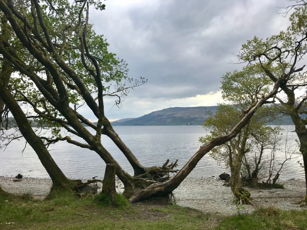
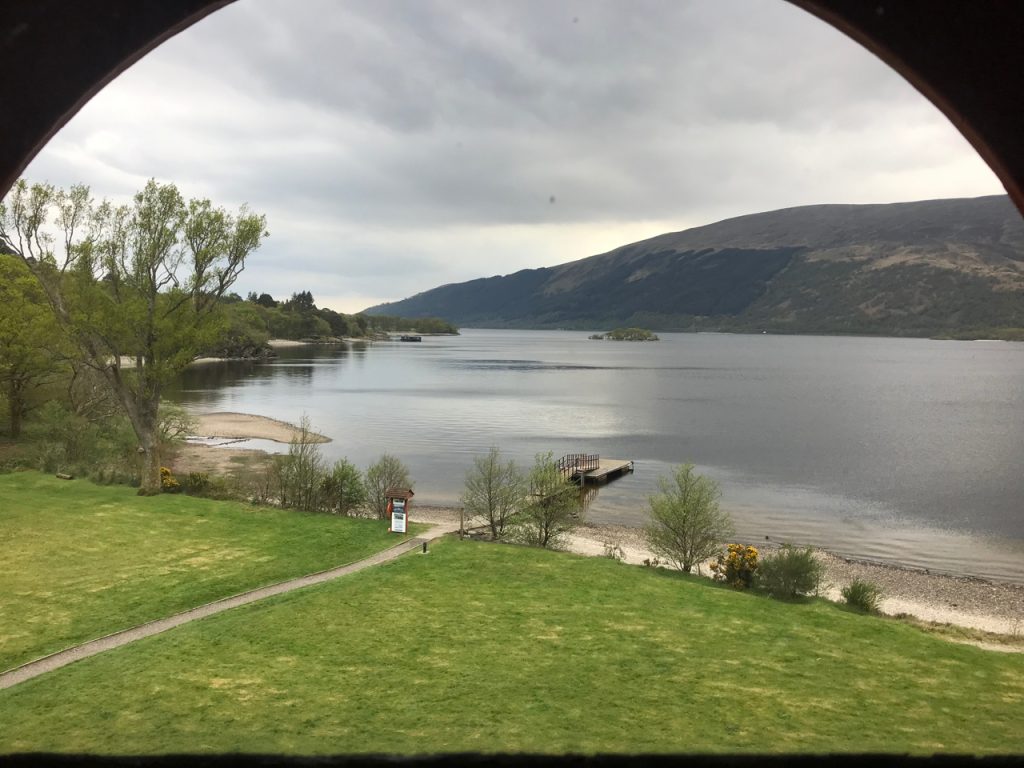
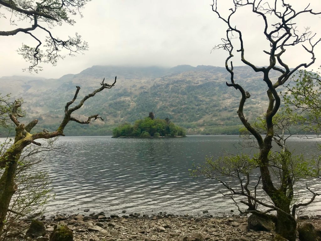
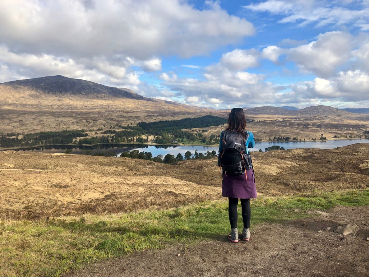
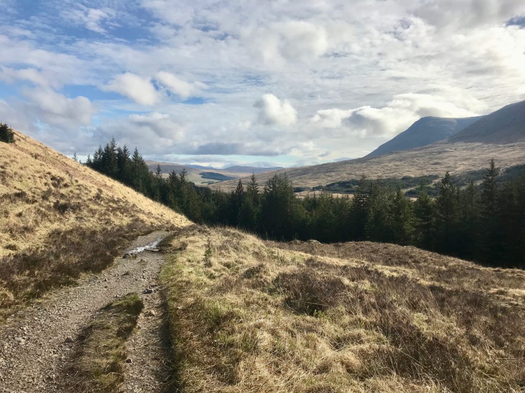
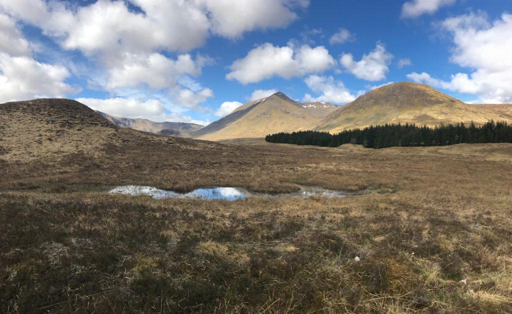
The trail today started just behind the hotel, across the Bridge of Orchy, and immediately up into a forest that soon opened onto a moorland that overlooked Loch Tulla.

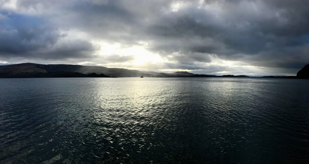
The day just happened to be sunny and bright with huge puffy clouds that reflected perfectly in the loch. The Fleming estate on the opposite shore looked cozy among the pines that surrounded it. We stood atop each hill that the WHW gently crested, soaking in the view before us. The trail took us down to the Inverornan Hotel at 2.6 miles, which was the perfect stop for a toilet. There is a small walkers bar, and it too looked like a great place to stay.

Thing to note: there are no good places to go to the bathroom along the trail because it’s hard to get out of the view of people. There are few trees to hide behind, so I found myself running around curves real quick to pee, hoping the folks behind us would slow down!

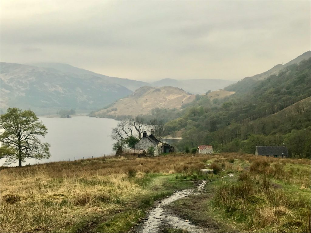
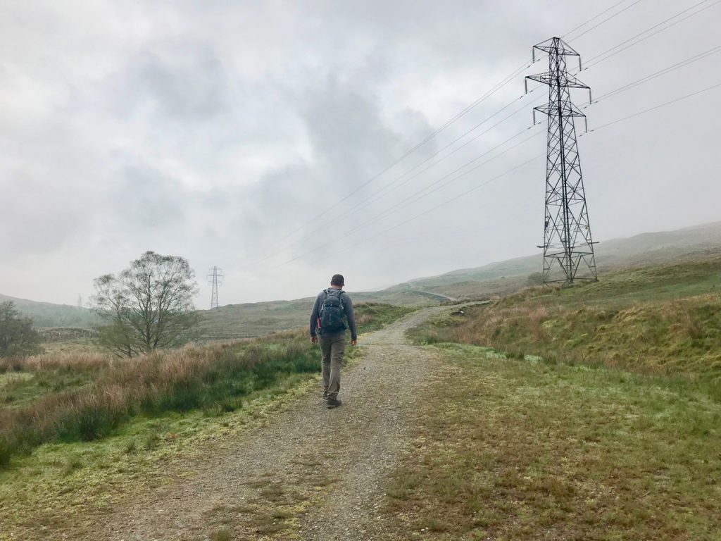
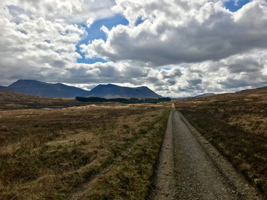
As we continued down the road and back into some woods, we crossed the Victoria Bridge and the Forest Lodge. The WHW became an old road that was used to move livestock back in the day, and the cobbles were BRUTAL beneath our feet. The road continues up on a gentle slope, but it goes up for so long that you are winded the whole time unless you intentionally slow down.

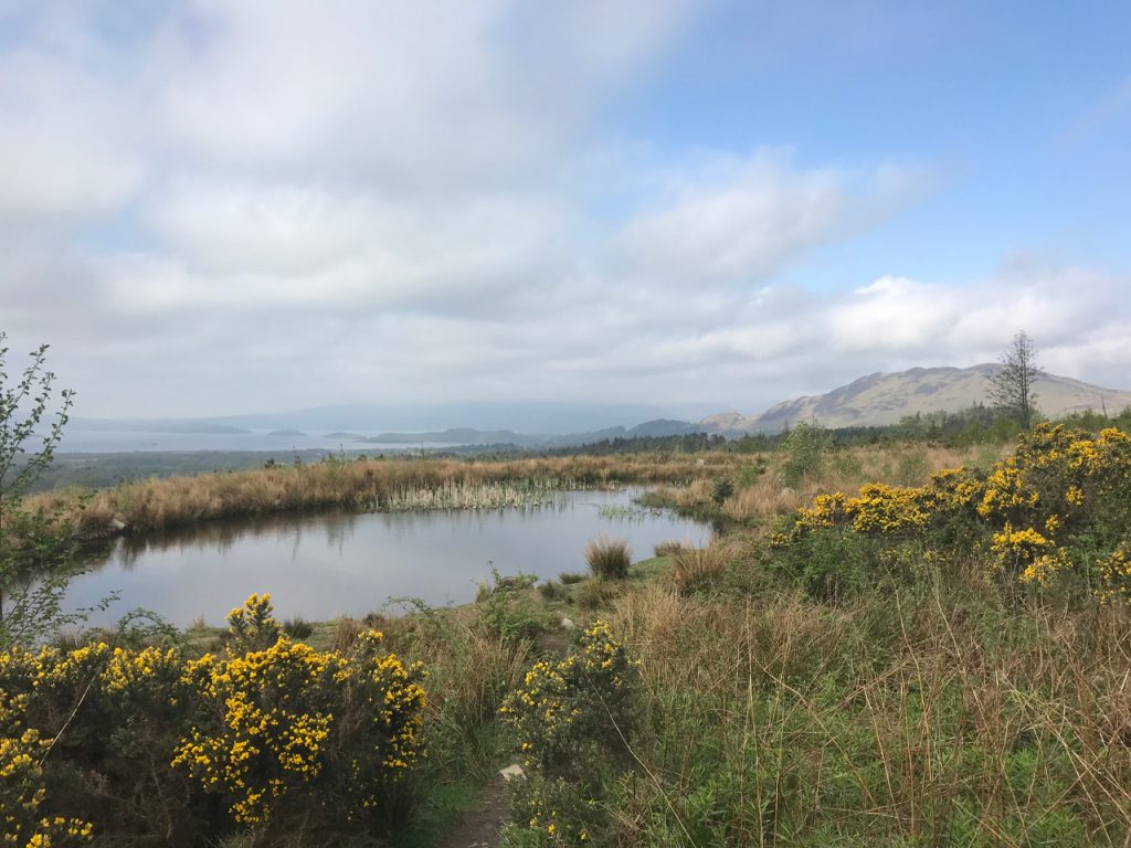
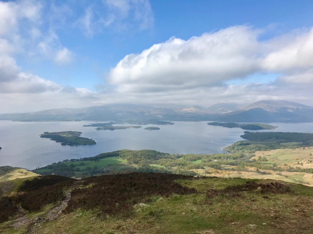
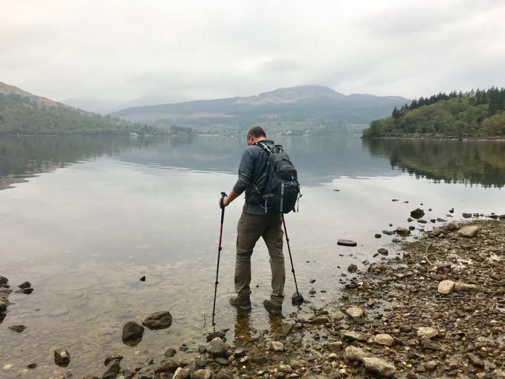
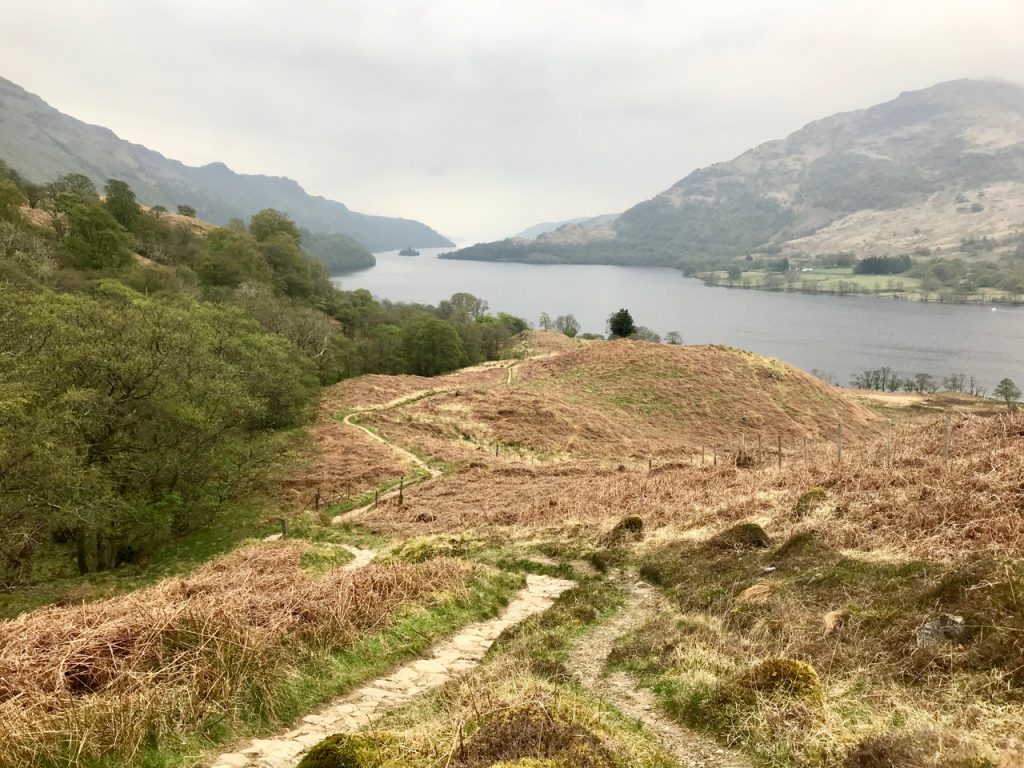
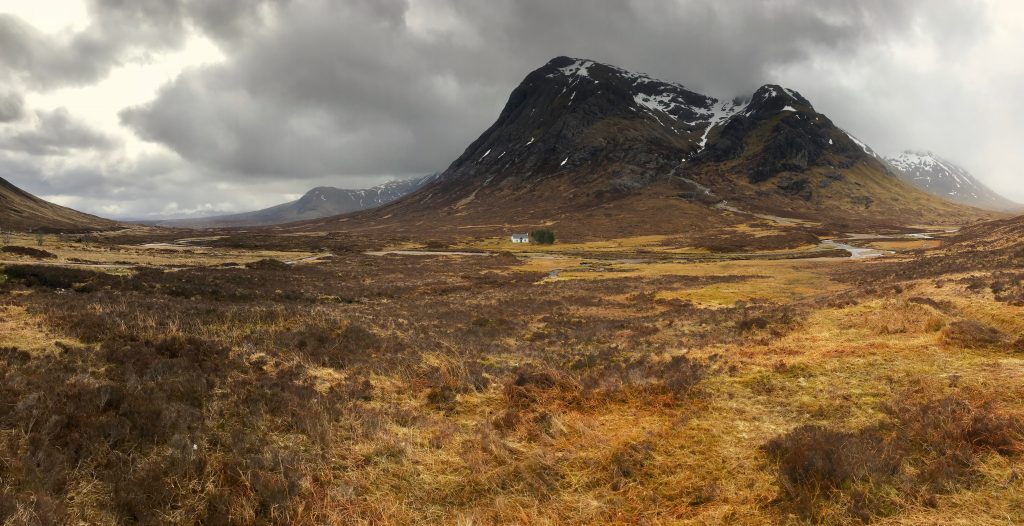
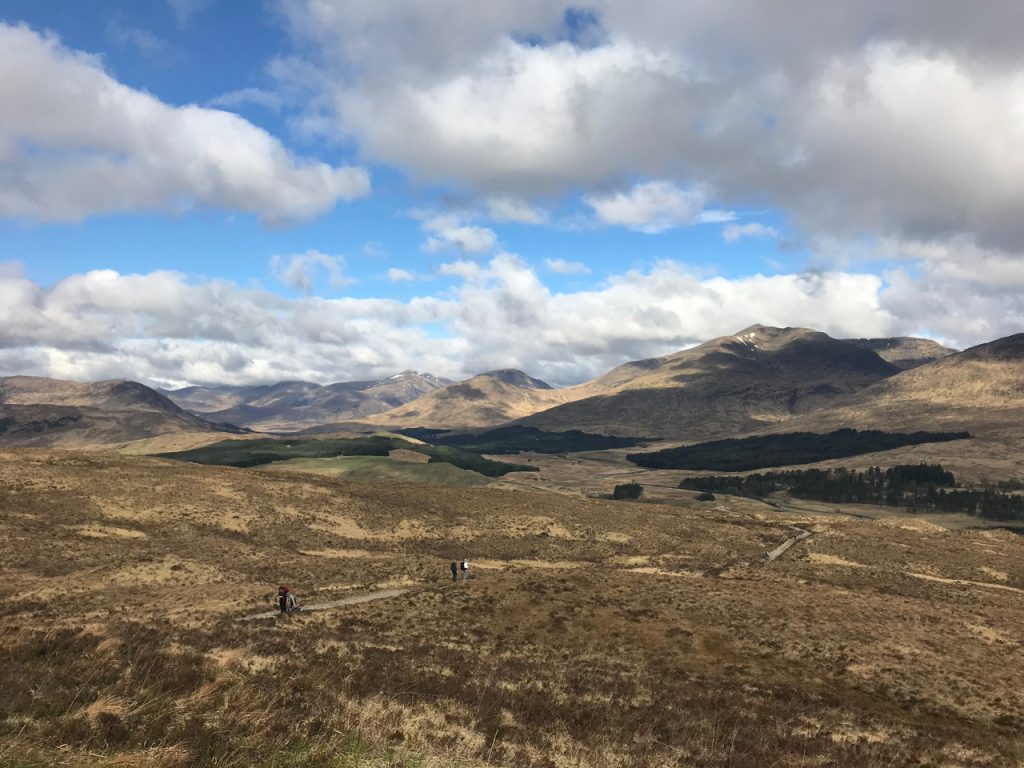
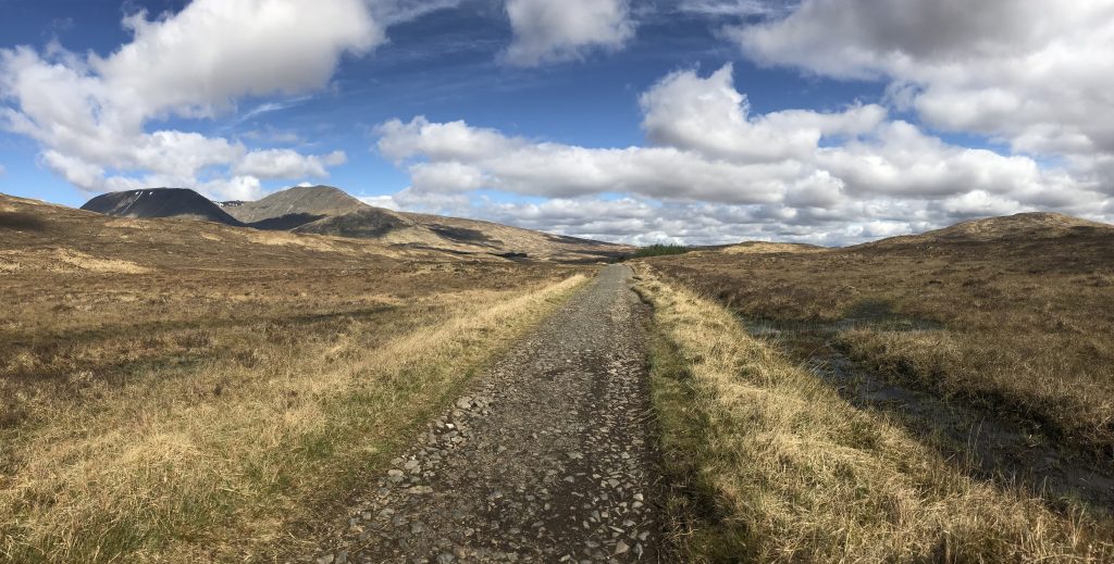
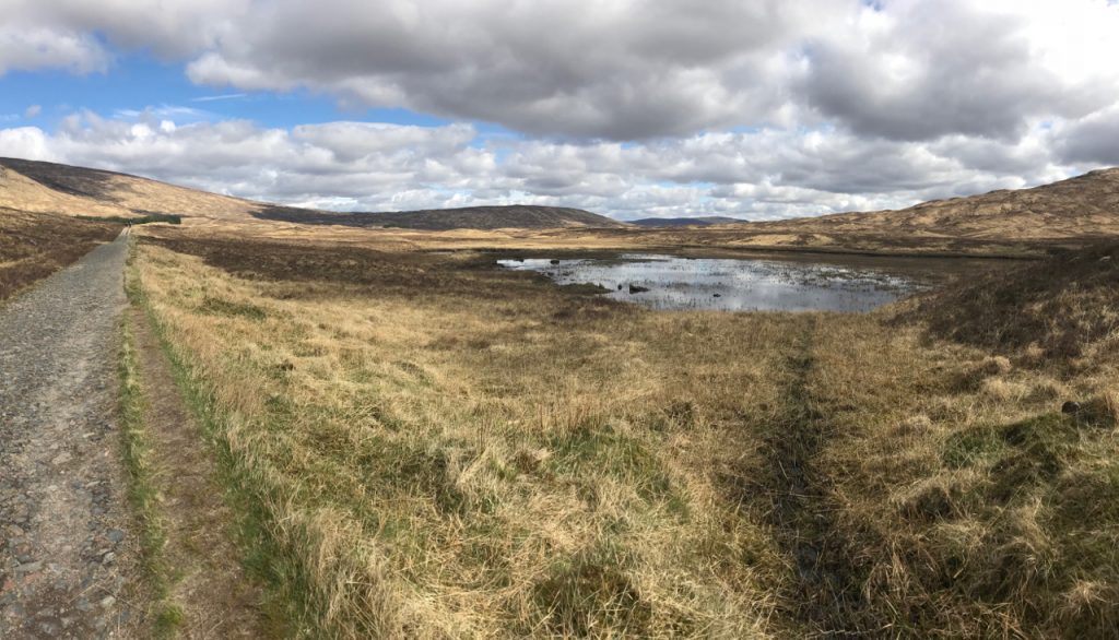
Walking across the Rannoch Moor was my favorite part scenically of the WHW, even though it hurt my feet the most. The views are open and outstanding! There are places to stop and sit along the way, just gazing out on Britain’s largest expanse of wilderness. There are few places along the way where you feel like you are really out there in the wild, but this is what I imagined it would be like, and I drank it in.

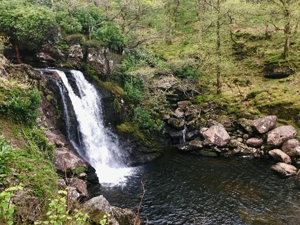
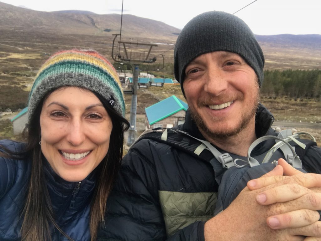
When we finally reached the top of the hill that signaled our descent into the Glencoe Ski Centre, I was ready to be done. Tiny cars could be seen whizzing by on the A82, and since the day was so clear, we decided to ride the ski lift. Even though the price was 12 pounds each, it was a lovely ride up the mountain beside a huge waterfall. The sensation of being carried and moved along felt quite nice.

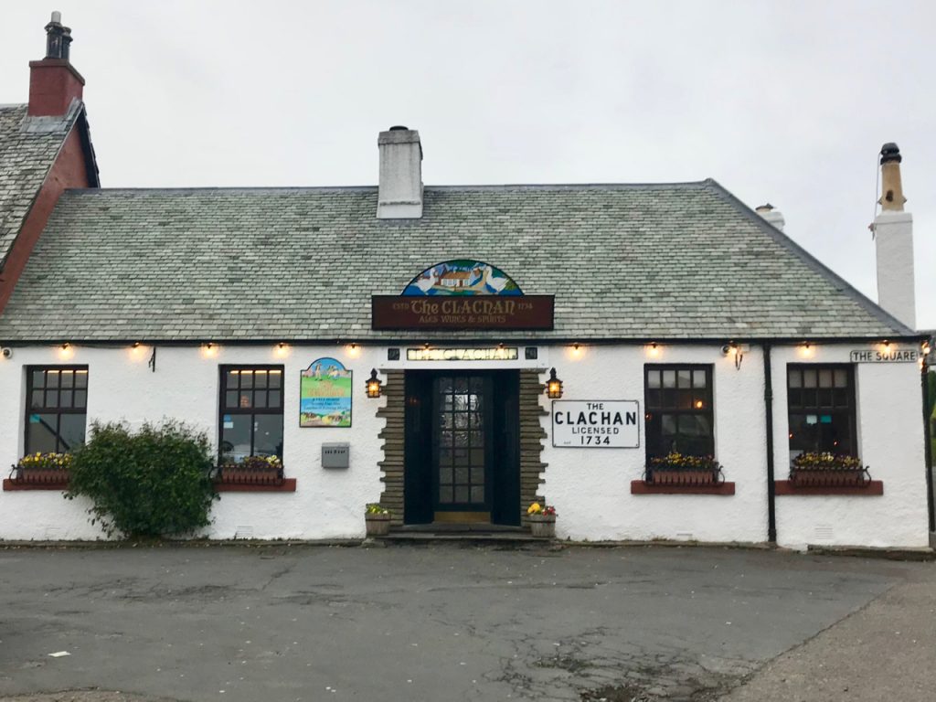
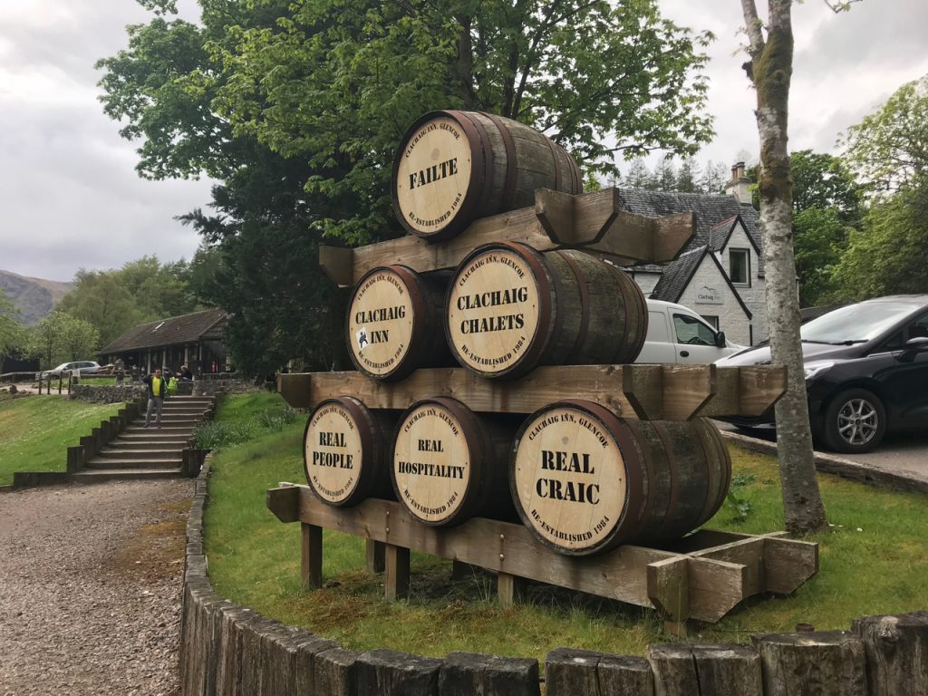
The Kingshouse Hotel was recently redone and now costs an arm and a leg so we got a taxi to Glencoe, which turned out to be the best decision we could have made. The bar and restaurants at the Clachaig Inn are wonderful, as are the people who run the hotel and provide a friendly, warm welcome.

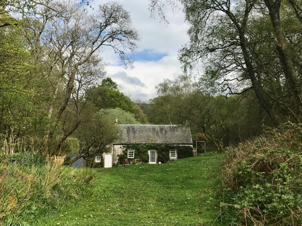
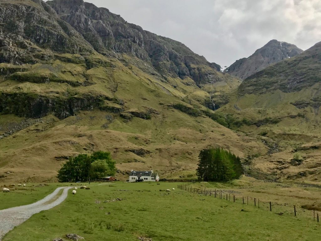
I love this area so much that I decided to go for a walk (I know, I know…) down the road, across the A82, to my favorite house in Glencoe, which is likely the most photographed in the area. I can’t think of a place that is more perfectly situated and standing before it made me so utterly happy.

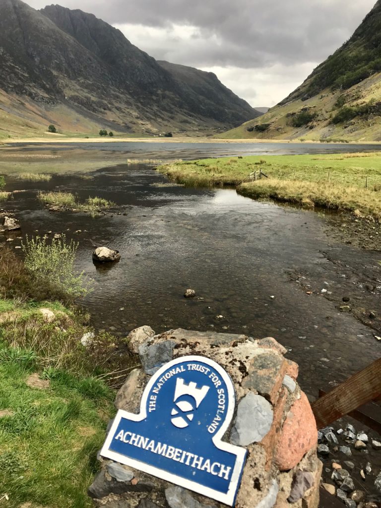
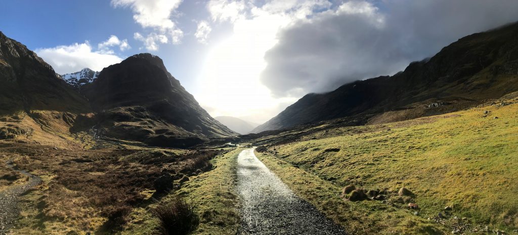
Even though Glencoe is out of the way, it would be such a shame to miss it. About 3 miles from the Clachaig is an area called the Three Sisters with several hiking trails. The tricky thing is getting there. There are several car parks, but sometimes the buses don’t stop there. You could always walk, but….the thing is, once you drive through that area and see it, you’ll be wishing you’d done everything you could to explore it. There is also a visitor center near Glencoe town with historical and hiking trail info. This is one of the most stunning areas we’ve been to on both our visits to Scotland and is really worth the side trip. The town itself isn’t much to speak of, it’s more the vistas. Clachaig and Glencoe Gathering are the best places to eat.

Tomorrow we get a taxi back to the Glencoe Ski Centre where we’ll continue the trek to Kinlochleven.

Related posts:

/west-highland-way-prep/

/whw-milngavie-drymen/

/scottish-highlands-glencoe/

Conic Hill

West Highland Way: Days 1-3, Milngavie to Inverarnan

This post was originally published on All Women All Trails, a community of adventurous women sharing their experiences in the outdoors.

Day 1: Milngavie to Drymen 12 miles

Had I known how tired we’d be after our flight, I probably would have opted to just stay in a B&B this first day to rest up and prepare ourselves for walking. The terrain the first day was very easy though, and 12 miles didn’t seem like it would be too hard on flat-ish ground. After getting some pictures at the start of the West Highland Way in Milngavie, we walked through a lovely park where the woods were filled with bluebells and lots of birdsong.

We passed through several pastures of sheep, the first of many on the WHW. It was quite common to arrive at gates where you’d have to unlatch the door, walk through, and make sure it was securely latched before heading on. The walking on this first day was taking us out of the populated areas, so it included some road walking, pasture walking, paths that skirted behind homes and through the woods beside roads.

Unfortunately, we arrived at the Glengoyne Distillery a bit too late to get a tour, but the folks in the shop gave us some samples of their whisky. It looked like a nice place, but we headed on to the Beech Tree for a cuppa tea and the best scone I’ve ever tasted. The owners there were so nice and even took time to sit down and talk with me because I had all kinds of questions about the birds we’d been seeing and hearing along the way. There is a small petting zoo of sorts with ponies and animals. It’s an interesting little place to sit a spell and revive oneself before the final push to our destination for the night.

We felt like it took forever to get to Drymen, because the road just kept going on and on, and our jet lagged bodies were so ready to plop down on a bed. The town is adorable and we stayed at The Hawthorns, a lovely B&B just off the center of town. Dinner at the Clachan, was the best way to end the night, and arguably had the best sticky toffee pudding we tried along the entire trail. Yes, we ate it every night and had a rating scale because it’s maybe the most perfect dessert every made.

Be sure to book ahead for dinner at every place you can. We learned this on our last trip to Scotland and saw walkers being turned away at the Clachan because they didn’t have a reservation. The town has an ATM and Spar market. We packed out some meat and cheese for snacks during the day, along with Cadbury bars because the chocolate really tastes better on the other side of the pond.

Day 2: Drymen to Rowardennan 16 miles

We headed out of Drymen, and as soon as we stepped back onto the WHW, it felt like we were finally getting away from civilization.

The trail goes through several forests, and we started to get view of Loch Lomond and Conic Hill. We went through several sheep pastures on the way to Conic Hill and made the long climb around to the top. The view became more dynamic with every turn until we could see Loch Lomond before us in all her glory.

We climbed the remaining 361 feet to the top of Conic Hill and it was absolutely worth it. Such incredible views of the loch. As we headed down, there were lots of steps, and the terrain became very rocky.

The trail takes you straight into Balmaha where there is a visitor center across the street from the Oak Tree Inn. The Oak Tree had a lovely outdoor patio to sit on and eat a delicious lunch while drinking a beer and pondering how lucky you are to be at that very place at that very moment in time. The village shop next door has snacks.

We headed on after lunch and began the climb out of Balmaha. Our B&B owner warned us this second half of the day was harder. There is still quite a lot of flat walking, plus a few roads, but much more of a roller coaster skirting the edge of Loch Lomond. The climbs in this section are steep, some containing stairs. Our muscles were tired and we still hadn’t caught up on sleep, so every hill felt harder than it was. I’m convinced that had we been rested, this wouldn’t have felt so arduous.

The WHW is really a gravel pathway. It’s so unlike trails that I’m used to in the US. Because the path is very hard and gravelly, which seems to be tougher on the muscles too. We enjoyed the views of the loch when we had them, and passed through quite a gorgeous forest along the way.

Tonight’s stay is at the Rowardennan Lodge Youth Hostel and we have a million dollar view from our room. This building is quite impressive for a hostel and there is a hefty supply of beer and snacks behind the front desk. We opted for the meal vouchers and honestly, the food wasn’t that good. We had chili for dinner and a sad breakfast the next morning. Meals were pricey, consisting of straight up cafeteria food. Our room was nice though and we never had any difficulty with sharing bathrooms or showers. If I stayed here again, I’d bring my own food. The Rowardennan Hotel was already booked up when I’d made reservations for this trip. It was quite the sad occasion walking past a hotel on our way to the hostel.

Tomorrow is said to be the hardest day on the trail, so we’ll see!

Day 3: Rowardennan to Inverarnan 15 miles

Today was my favorite so far. The walk along Loch Lomond was challenging and breathtaking with views of the loch the entire way. We took the lower trail, which is harder than the upper trail, but so much more rewarding in terms of beauty. We saw lots of birds and wild goats too!

The forest was mossy and green as could be, emerald in fact. Pictures will never do it justice! Tons of up and down over tree roots, down rocky steps, with the trail constantly changing. I enjoyed it so much more than the flat stretches we’ve had. We passed a couple of people who seemed to think it was the pits, but it reminded me of the Appalachian Trail. Highlights were seeing some of the old estates, visiting a bothy (Scotland’s version of a shelter), seeing wild goats, and finally feeling like we entered the wilderness of the highlands.

The birds here are so beautiful. We’ve seen European robins, a blue tit, chaffinches, great tits, some kind of plover, European goldfinches, heard a cuckoo, and saw so many more that I couldn’t identify. It’s killing me not knowing what they are and no one around here seems to know either. We also heard some frogs trilling today. The black slugs have been so interesting. They are huge and deep velvety black. If you’re into nature, this trail definitely has its fill!

We stopped at the Inversnaid Hotel which was SUCH a cool place. There is a rushing waterfall right before you arrive, which felt like a good omen. The hotel requires you leave packs and boots in a little warming room at the hikers entrance. Walking through a nice hotel in socks seemed wrong somehow, but everyone else was too, and now I want to walk through fancy hotels in socks all the time. The bar was out of half the food on the menu, but we liked the sandwiches we had. The pot of tea seriously saw me through the rest of the day after a dreadful breakfast at the hostel. Inversnaid was a really pleasant stop in the middle of the day. The luxury of the WHW is all the food stops dotted along the way. We carried minimal snacks with us because it’s not hard to stop for a full midday meal while walking.

As we passed the little cabins at Beinglas Farm, I was sad we weren’t staying there instead, but you need to have your own sleeping bag if you stay in the little cabins, or have camping equipment. They did have a nice store though and seemed to be a great place for a stop if you decide to carry gear.

The Drovers Inn is a bit off the WHW, and definitely did not meet our expecations. When we checked in, they put us in the lodge across the street, which has no wifi, and feels more like a trailer. The bathroom is shoddy and looks dreadfully cheap, like it was put together in a hurry. Dinner in the bar was great though and is definitely worth the visit. There is taxidermy all over the place, which adds to the lodge-like feel, but if I were going to do this again, I’d stay at Beinglas and then visit the Drovers bar.

I’m still not crazy about the fact that the WHW feels like a road through the woods. I guess this makes sense because many of the paths are old drovers roads, but I miss rugged terrain. Today was such a relief from the last two days of hard gravel. I loved that the trail went a bit wild with roots and rocks. This is supposedly the most challenging part of the trail, and I’m sad to say goodbye to it.

There are some solo walkers on the trail, but not many. I think this could be a lonely endeavor as a solo walker except for those really longing for solitude. Unless you’re willing to butt in with the groups on trail, it seems like there’s not a ton of social interaction that isn’t very intentional. Many people are walking in pairs or in groups. I don’t feel like safety would be an issue at all if going solo. It’s more the social aspect that could be hard.

Tomorrow we have 20 miles to walk. It’s also supposed to rain, so I’m hoping that it holds off, or is just misty like it was today.

Related Posts:

/west-highland-way-prep/

Glencoe

Everything You Need To Know When Planning A Walk On The West Highland Way

This post was originally published on All Women All Trails, an online community of dynamic women sharing their experiences in the outdoors.

Rarely a day goes by when I’m not thinking about future trips and outdoor adventures. I often check Southwest and Google Flights for deals and am subscribed to email lists like Airfare Watchdog, Scott’s Cheap Flights, and Cheap Flights. The Points Guy is another great travel resource and he often posts when airlines are offering deals. So one day I happened to be casually checking Google Flights to see what the fares to Scotland looked like. My husband and I had traveled there in April of 2018, and had such an incredible time. A small peek at flights could never hurt anyone. Sure enough, I happened to be looking during a two day fare sale where flights were literally half what we’d paid 5 months earlier to fly into Edinburgh. Naturally, I called my husband and said, you want to hike the West Highland Way next year? His response was less than enthusiastic, but at the same time, I think he knew…there was no way he was getting out of this.

Our flights were booked in September of 2018 for the end of April 2019. I knew nothing about the West Highland Way (WHW) aside from postcards I’d seen at a gift shop in Fort William. This was a “ready, fire, aim” situation with these flights. Upon quick research, I learned the trail is 96 miles long and travels into the highlands from Milngavie, just 6 miles outside of Glasgow, into Fort William, which sits at the foot of Scotland’s highest peak, Ben Nevis. Typically the trail is completed in 5-7 days, which makes it a very reasonable excursion for anyone who works full time and doesn’t get a ton of paid time off each year.

There are many tour companies in Scotland who will book your entire WHW trip, including accommodation, baggage transfers, and any other needed transportation such as trains and buses. For those of you who are planners and want to save some costs along the way, I’m going to focus on the steps we took to book the entire trip ourselves.

Social Media Groups

Some Facebook hiking groups provide excellent information where hikers and walkers can ask questions and get feedback from people who’ve already walked the trail. I found this very helpful and informative, and would suggest joining one or all of the West Highland Way groups on Facebook.

Maps & Navigation for the West Highland Way

  • If you don’t already have one, obtain a guidebook as soon as your flight is booked. There are many, many options for guidebooks on the WHW, so it’s likely you’ll be fine with several of the options available. The one I decided to go with is by Charlie Loran and can be purchased HERE. I do believe this has been updated as of 2019, so be sure to look for the seventh edition. What I liked about this book is that it includes information on places to stay in each town, camping locations, distances between each segment, time estimates, gear needed for the trip, conservation and nature info, wildflower ID photos, and detailed maps that include lots of helpful notes for every step of the way.
  • Download the Guthook app on your phone. For those of us used to hiking on long trails in the U.S., Guthook will be a familiar friend. You can either download the entire UK Trailblazer Guides package for $24.99, or just the WHW map for $5.99.
  • Download the maps.me app on your phone. If you want a backup navigation option just in case, maps.me is my go-to. Some friends who are world travelers told me about this app years ago and I’ve never looked back. maps.me is an offline map resource, so you need to make sure to download all maps for the regions where you’ll be traveling beforehand. It’s primarily for driving, but trails are also visible on the map and I’ve used it countless times to double check my location or get myself back on track while hiking. Users have the ability to save locations by starring them on the map so they can easily be found later. The app does take a bit of getting used to and is not as user friendly or detailed as Guthook, so I would suggest practicing with it before taking a trip.

Accommodation Along the West Highland Way

For those hiking the WHW there are a number of options for places to stay which will fit into every budget. Hostels, bunkhouses, and campsites are an economical choice for those on a tight budget. For anyone wanting to sleep in a plush bed at night after grabbing a pint and a warm meal at the pub, there are some lovely hotels, inns, and B&Bs along the way. These will cost more, but also make this trail appealing for anyone who doesn’t want to rough it in a tent every night.

Due to the fact that I was booking this trip less than a year out, I worried about being able to find accommodation in some of the towns we would pass through. Many of the villages are small with only a handful of places to stay. First and foremost though, I had to figure out our schedule and decide which route we’d be taking. Below is our daily planned mileage and accommodations. This does not include midday stops or side trails off the WHW.

Using the guidebook and looking online, I immediately started booking our hotels for each night. One thing I did not know and hadn’t accounted for is that the Pre ’65 Scottish motorbike trials will be taking place in Kinlochleven just as we are walking through. A few days later in Fort William, the Scottish Six Days Trial will be starting the day we finish the WHW. Honestly, I was devastated when I found this out.

My first thought was that the peace of nature would be destroyed with the sounds of dirt bikes whizzing past us as we all tried to use the same path. Realizing that this trip was happening no matter what, I needed to re-frame this story in my mind in a positive way. I forced myself to remember that we are going to another culture that has different views about land use. The mindset of conservation and wilderness is an American concept, which other parts of the world have started to embrace over the past couple of decades. For example, Loch Lomond & The Trossachs National Park, which the WHW traverses, was only established in 2002. However, Scotland’s unique view of the land also makes it an ideal place for people to wander and explore. Statutory Access Rights are as follows:

The Land Reform (Scotland) Act 2003 (which came into force in 2005) gives everyone rights of access over land and inland water throughout Scotland, subject to specific exclusions set out in the Act and as long as they behave responsibly. These rights are sometimes referred to as ‘freedom to roam’.

Due to the trials, finding a place to stay in Kinlochleven was nerve wracking. Every single place I looked up was fully booked the night we’d be there. I started thinking about staying in another town and getting transportation there and back, but the logistics of that would have been tricky. Finally, after a glass of wine and another panicked online search, I found a small B&B called the Bank House Bed & Breakfast. Somehow, they were literally the only place in town with a room left and I can only imagine it was due to a cancellation.

Luckily Fort William is large enough that there were still several options available in spite of the trials. The only other town on the way that was almost completely booked was Rowardennan, most likely because it’s small with few options for hotels. We will be at the Rowardennan Lodge Youth Hostel which is situated right on the banks of Loch Lomond. We were able to get a private room and I purchased the breakfast option when booking.

Baggage Transfers on the West Highland Way

Another very appealing aspect of the WHW is that you are not required to carry a heavy pack as you traipse through the highlands on the way to your next pub. It’s possible for some people to have an authentic backpacking and camping experience, which would drastically reduce the cost of this trip. However, many folks opt to have their bags transferred from place to place so they can enjoy the walk with nothing more than a daypack on their back. European slack packing! Baggage transfers typically run £40-50 per bag per person for the entirety of your trip. Some popular transfer companies include:

Transportation

  • If you fly into Glasgow, you will need transportation to the start of the WHW in Milngavie. A bus, train, or taxi will take you there. I would suggest looking into each and deciding what suits your needs based on timing and cost.
  • At any point on the WHW, you might decide that you’d like to stay in a different town, or be forced to if accommodations along the trail are full. We decided to skip staying in Kingshouse in favor of staying at the Clachaig Inn in Glencoe because, having visited before, we were completely in love with the scenery in that area. This meant finding either a bus or taxi from the Glencoe Ski Centre. The buses are far and few between, so I decided it would be worth it to shell out the £50 roundtrip for a taxi. I started looking in January to book a reservation for early May, and most of the taxi companies were already booked on that day. Thank goodness, I was able to find one and reserve our seats in a shared cab. Booking ahead is extremely important!
  • Once you finish the WHW, there is the option of a bus or train back to Glasgow. We will be taking the train from Fort William to Glasgow Airport, which will require several changes on both buses and trains. Our hotel for the last night is a very short walk from the airport. I would suggest booking your trips on Trainline because tickets become available much earlier than they do on the Scotrail website. I paid the fee to have physical tickets mailed to us because mobile e-tickets are not available for use yet at the station we’ll be traveling from. At this point I’m not sure how long it will take us to walk the miles we’re doing each day, so in case we miss the hours of operation for the ticket counter, we’ll have the tickets in hand and be ready to go.

I’m so excited for this trip and can’t wait to see how all the details fall into place. Sometimes the best laid plans end up changing due to unforeseen circumstances, but hopefully this experience on the West Highland Way will be a memorable one we’ll treasure for years to come. Now, the focus will be on gear and how to efficiently pack everything we’ll need for the hike into a 60L duffel bag. Not to mention leaving space for a bottle or two of Scotch whisky!

Related Posts:

/luss-loch-lomond-the-edge-of-paradise/

/scottish-highlands-glencoe/

Appalachian Trail Georgia

AT Journals: You’re Not “Just” A Section Hiker

This post was originally published on All Women All Trails, a community of adventurous women sharing their experiences in the outdoors.


 I have a memory from when I was a little girl on a trip to Vermont with my family. I can’t remember the exact spot, but we were driving through a park and noticed a wooden sign with white letters on the left side of the road. It said “Appalachian Trail.” My dad commented that he didn’t realize the AT went right through there. Little did I know that a seed had been planted. Someday, later in my life, a dream to hike the entire 2,192 mile length of that trail would become an obsession of sorts.

Amicalola Falls

Life happens, you develop a career, a family, put down roots, and still the dream persists. Somehow in the middle of that, I’ve managed to hike 1,500 miles over the past few years on trips to national parks, day hikes, and my beloved local trails that prep me for every adventure. While I’ve been able to do small bits and pieces of the AT over the years, I hadn’t done any multi-day trips. Over and over I’ve had people tell me to quit my job, just go for it, don’t wait around. While I love the passion behind these sentiments, I don’t want to throw away a career I’ve worked hard to build and a job I feel really blessed to have. So I decided that 2019 would be the year I officially start section hiking the AT. It’s time to combine all the bits and pieces and start highlighting the trail map with finished sections.

When I realized I had two days off over President’s Day weekend, an idea quickly hatched and I headed to Amicalola Falls to begin the journey. I felt physically sick to my stomach. I’ve done some small backpacking trips now, but would I be able to handle this? What if I got out there and realized I hated it? What if I didn’t fit in out there? What if my body fell apart on me? What if I was scared out of my mind? What if this whole dream was a sham? I choked down these fears as I drove, along with a protein bar I was forcing myself to eat because I knew I’d need the energy.

The weather was overcast with dense fog and so much mist that droplets fell from the trees like rain. I filled out the information at the Amicalola Falls Visitor Center and was told to park my car up a dirt road in a specified area that would be “really obvious.” I drove up the dirt road three times, not sure where to park, looking for the famous arch, until a truck drove by and someone who tests the water pointed to a spot. When I asked him where the arch was and where the Approach Trail started, he pointed through the woods and said to just walk until I came to a trail. Uh, ok. All alone, on some random road, with my pack on my back and my stomach doing somersaults, I headed into the woods with Guthook pointing the way until I came to a trail. Ok, here we go. What I didn’t realize until later is that I was on the East Ridge trail, the original Approach Trail to the AT. It goes to the same place as the new Approach Trail, but instead of walking straight until you hit the stairs, you start going directly uphill in the woods.

I passed a man day hiking who asked if I was going thru. “No, I’m just section hiking through the weekend.” Just section hiking? Hmm. Throughout the day, I had people stop me on the trail. “Are you a thru hiker?” “No, I’m just a section hiker?” They’d nod, tell me to have fun, and keep going. Somehow, unconsciously, I felt like I didn’t deserve to be out there as much as the people who were accomplishing a feat of endurance that would last for the next 4-6 months. Even though we’d all be walking the same terrain at some point in time.

There is so much emphasis placed on thru hiking long trails. Podcasts focus on it, countless books have been written about it, social media groups attempt to prepare folks for the arduous journeys they embark on…and yet, most of us in our lifetime will not be able to leave our jobs or take 6 solid months out of life to be able to do that kind of hike. While it is a dream for many, it is a reality for few. I wish there wasn’t an unconscious stigma that seems to imply that section hiking isn’t as important or as valid as thru hiking. Don’t get me wrong, I have so much respect for thru hikers, and I wish with all my heart I could do the same. What an incredible experience to have, and what athleticism and mental strength it takes! But at the end of the day, when years go by, section hikers and thru hikers all walk the same steps, hike the same miles, and treasure their experiences on these trails in much of the same ways.

Appalachian Trail Georgia

I get it now. I understand why people skip the Approach Trail. I put my headphones in and hiked uphill to the beat, counting down the miles until I would reach Springer Mountain. My anxiety from the drive melted as my feet found their natural rhythm among the roots, the rocks, and the mud. I was home. The trail is where I belong. Closer and closer to Springer until finally the mountain laurel cleared and the rocks that held the plaques signaling the start of the AT appeared. There were two hikers there who were just packing up to head to the Springer Mountain shelter. One was carrying a full sized guitar, the other was talking about how loud he planned to snore that night. I immediately decided to hike on to Stover Creek shelter for my first night’s stay. I was exhausted from the approach and wanted to sleep well. After they left, I sat next to the white blaze and the hiker plaque and cried tears of joy. I was actually here. I made it. This wasn’t just a dream. This was the reality I was sitting in. After years of seeing pictures of this rock, I was touching the first blaze, thinking of all the people who’d had their hands and feet in the same place over the decades, gathering strength from them.

Springer Mountain

That night, I set up with another woman in the shelter, just the two of us since the guys had decided to sleep under their tarps. Everyone here was thru hiking and couldn’t have been nicer. All from different backgrounds, different states. Some of us planning to do the same miles the next day. The rain sang on the tin roof as I drifted off.

I was on the trail for 4 days, completing the 8.8 mile Approach Trail (I went back at the end and got pictures by the arch and did some stairs), 38.2 miles of the AT, and 1.2 miles getting to each shelter, for a total of 48.2 miles. It was such an awesome 4 days, and I can’t wait to head back for 9 more days later this year. I was the only section hiker out there, and everyone I met was wonderful. I’ve never had the experience of being in a group of strangers, all in the same situation, helping each other out by sharing food, gloves, hand warmers, gear, and stories.

In 4 days I had two instances of trail magic, which were such a surprise and so kind that I was really quite touched. A thru hiker from last year who lived in the area hiked up and over Blood Mountain in the howling winds and rain just to bring some fresh fruit and candy to us in the shelter before hiking back that night. Then, the shuttle driver who took me from my endpoint at Hogpen Gap back to Amicalola wouldn’t let me pay for my ride because he’d enjoyed our conversation and said he loved helping hikers out. I completely understand why faith in humanity is restored on these trails.

This section ended up being an incredible confidence builder for me. I realized that all the research and investment into lightweight gear has paid off. Even in terrible weather, I can enjoy myself out there. Being alone is a peaceful, necessary experience for me. And most of all, I have the strength inside of me that is needed to continue chipping away at sections of this trail until I’m able to complete it. When I was saying my goodbyes to the hikers I’d met, one of them said, “I hope you get to do a thru hike someday.” And I replied, “I’ll be happy if I’m ever able to say I’ve completed the trail, no matter how long it takes.”

/appalachian-trail-ga/

/appalachian-trail-shakedown/