

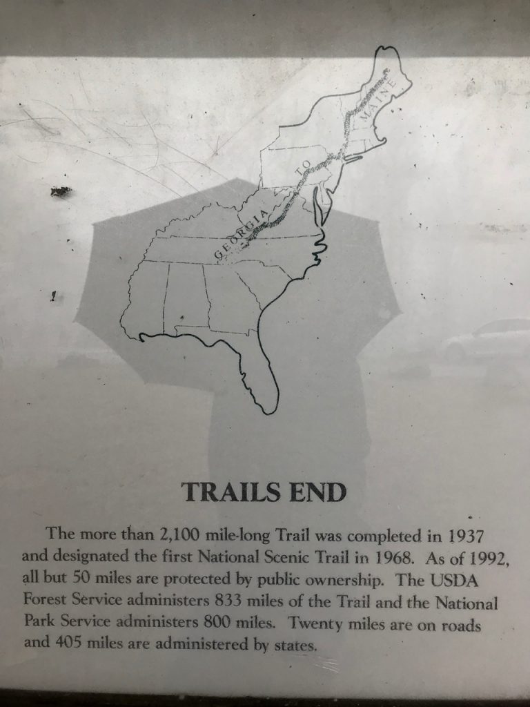
This past weekend I had a couple of days off and was planning to go to the Smokies for a short backpacking trip. The weather put a wrench in my plans with rain in the forecast everyday, so I made the last minute decision to head to Amicalola Falls and start section hiking the Appalachian Trail instead. Later this year, I have a 9-day section planned, but I figured if I start now, I could get farther north when I go then. I stressed over my gear, added things, eliminated things, weighed my pack 18 times, and finally decided that it was as good as it could get at 24 pounds, including food and water. Moment of truth…
The morning I drove to Amicalola I felt physically sick. My nerves were completely shot and I was gagging on a protein bar I forced myself to eat because I knew I’d need the energy. So much of me was worried I’d fail at this. Maybe I couldn’t make it up the hills. Maybe this dream wasn’t meant to be a reality for me. What if my body completely gave out on me? What if the other hikers weren’t friendly? So many insecurities and fears swirled in my mind. All my previous hiking experience didn’t seem to matter because I’ve held the AT on a pedestal in my heart. This is the trail that means the most to me. If I can’t do this, am I really a hiker? (The answer to this question is yes, by the way)
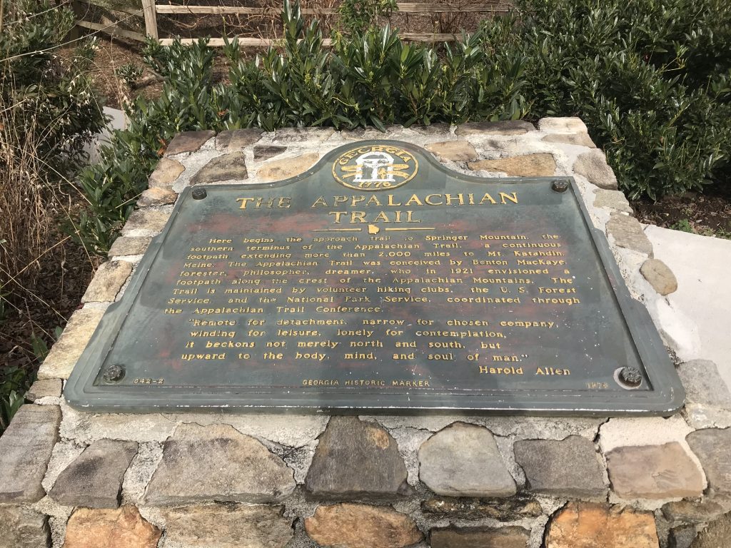
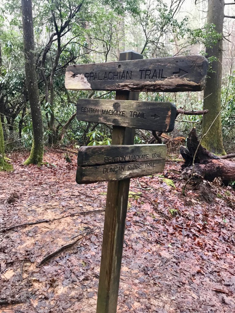
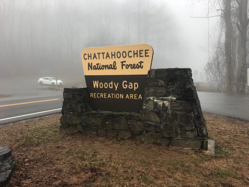
THE APPROACH TRAIL
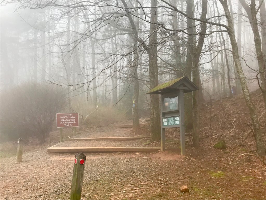
When I got to Amicalola Falls Visitor Center, I registered and paid $5 to park my car for a few days. I was told to drive up a dirt road by the kiosk where there would be “really obvious” parking. I drove up the dirt road, saw some parking signs that couldn’t possibly be right, so I kept going up this crazy steep incline, freaked out, turned around, went back down, couldn’t see a trailhead, didn’t know what to do, turned around, drove up again, came back, WHERE THE HELL IS THE TRAIL?! I finally flagged down a man who was testing the water that day. He didn’t work for the park, but directed me toward the vague parking area and said that if I just walk through the woods toward the visitor center, I’ll hit the trail. Uh, ok. I was looking for the famous arch that signals the beginning of the Approach Trail, but there was no arch, there wasn’t even a trail to get to the trail. So I pulled up Guthook and headed into the woods until I came to a trail and turned right. Rather an anticlimactic way to start. What I didn’t realize was that I was on the East Ridge Trail, the original approach trail to the AT, but not the present day one that includes a ton of stairs up to the falls.
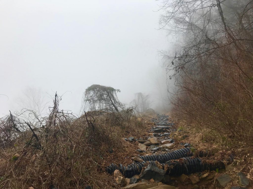
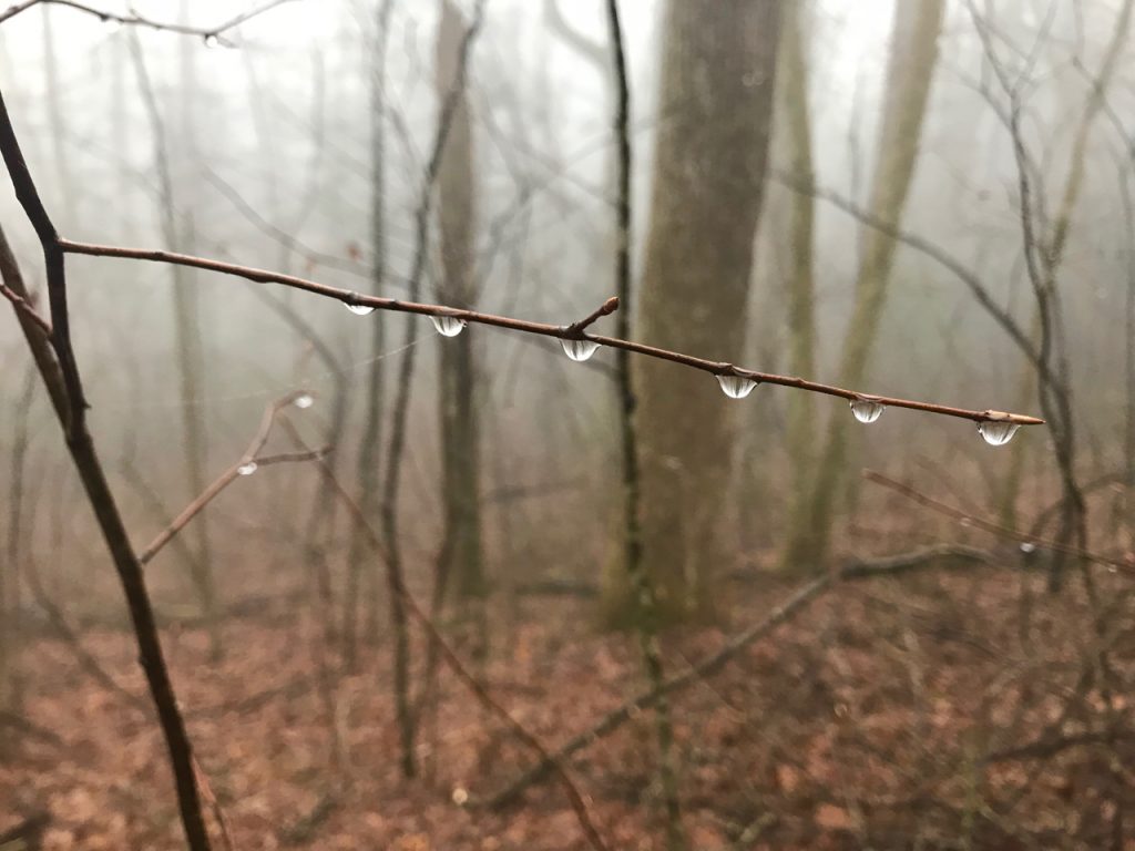
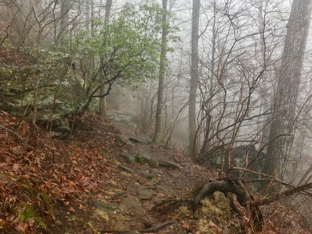
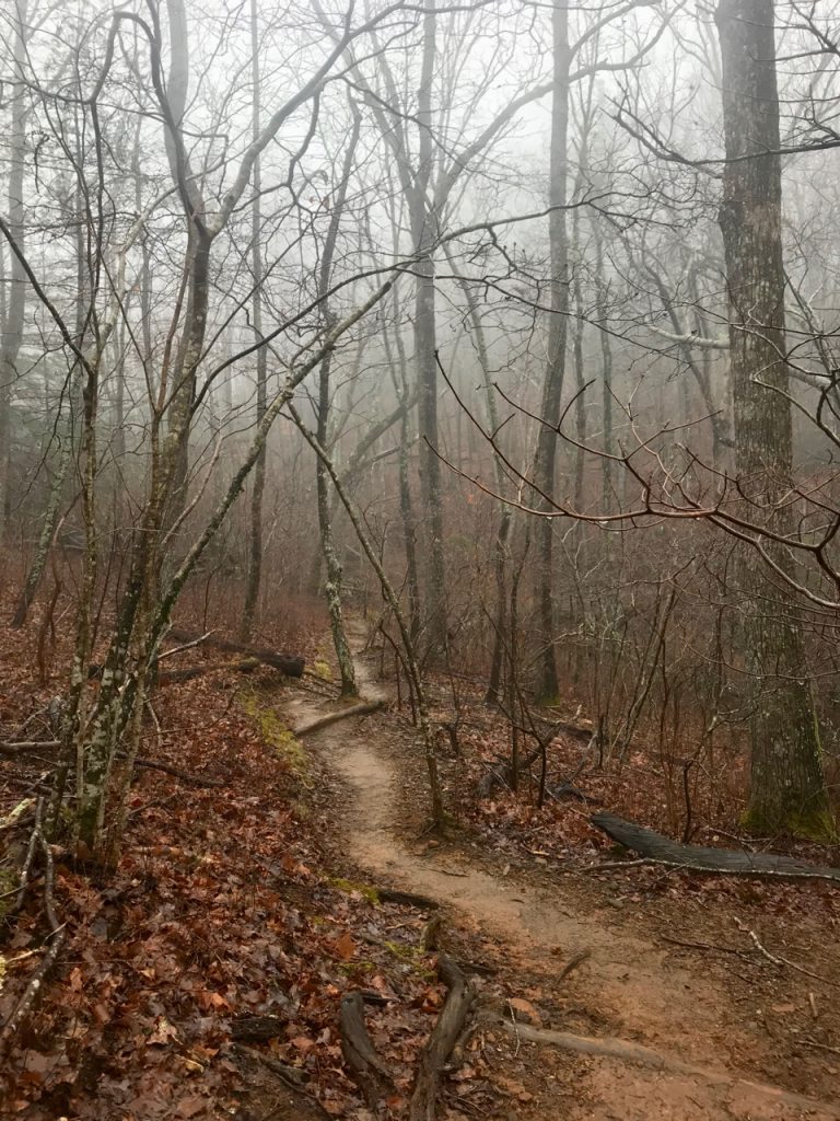
Immediately the trail headed uphill. The threat of rain was weighing heavily on everything, and before I knew it, I’d hiked up into the mist that would be a constant companion for the rest of the day. The familiarity of hiking in clouds surrounded me, taking my mind back to the Great Smoky Mountains, wondering how hard the rivers there were raging right now. I decided to put some music in my ears as the uphill slog continued. The second I heard the first song of my hiking playlist, something changed for me. I looked down at my feet as they navigated the roots, rocks, and mud, and felt…at home. This was familiar. When I reached the Amicalola Falls parking area, I couldn’t see anything. Visibility was as low as it could possibly be and I could barely make out a brown sign signalling the continuation of the Approach Trail.
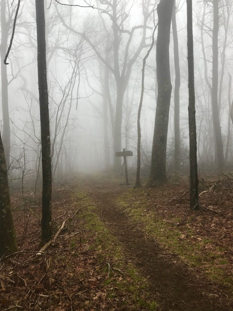
As the day wore on, I played mental games with myself. Maybe this trail sucked so much because I’d already heard it sucked so much, and my mind had already made up its mind about it. Is it me, or does it look like a tornado tore through these woods and made a big old mess of them? I hate the fact that these 8.8 miles don’t count toward the AT! Why on earth don’t they just add these on so people don’t feel like they’re wasting all this energy before they actually start the AT?!
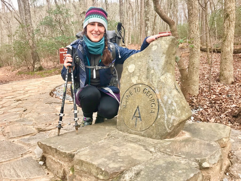
SPRINGER MOUNTAIN
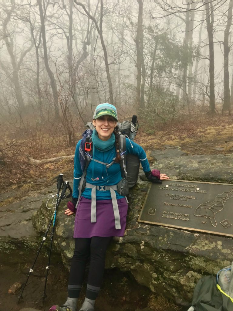
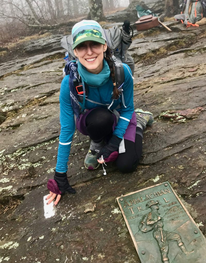
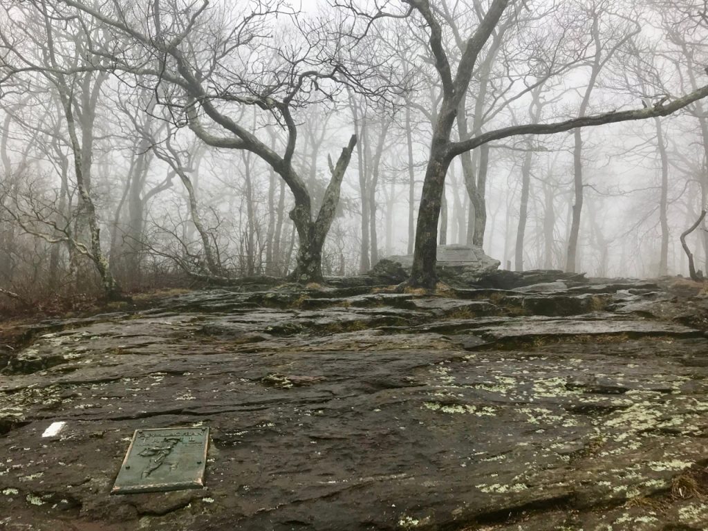
Everything in me was focused on Springer. I just needed to get to Springer. The plaque, the register, the first white blaze marking the start of the AT…these were the motivation that got me up every crummy hill on the Approach. Finally, the mountain laurel cleared and I could see large boulders and I knew I’d made it. Two men were already there, one older who had just flew in from Maine and forgotten a bunch of things, the other younger and carrying a full sized guitar in a case. I signed the register, talked with them a bit, took a few pictures and waited for them to head on. As soon as they were gone, I sat next to the plaque with the hiker and the first white blaze and cried. The gratitude I felt at being in this spot after dreaming about it for so many years was overwhelming. I’ve hiked small bits and pieces of the AT, but to be starting at the beginning and wrapping my head around a goal was very meaningful. A few more moments and it was time to move on.

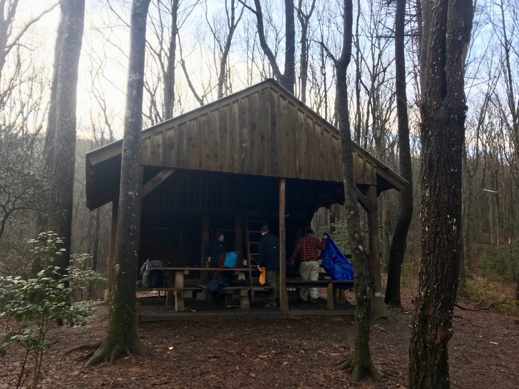
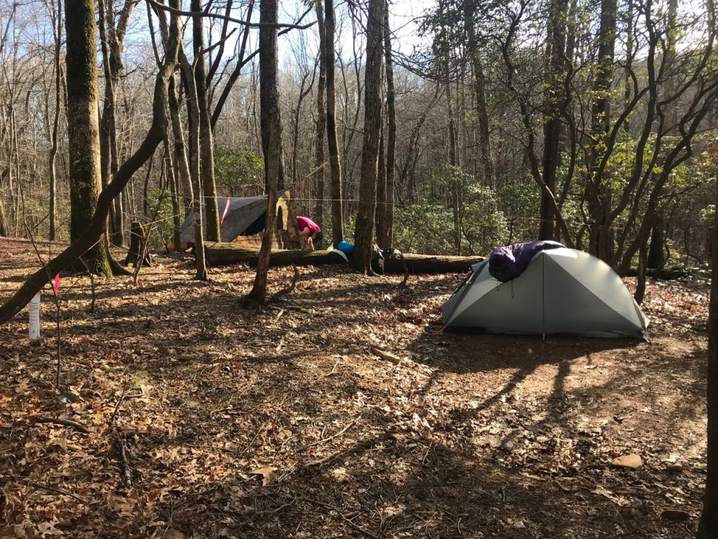
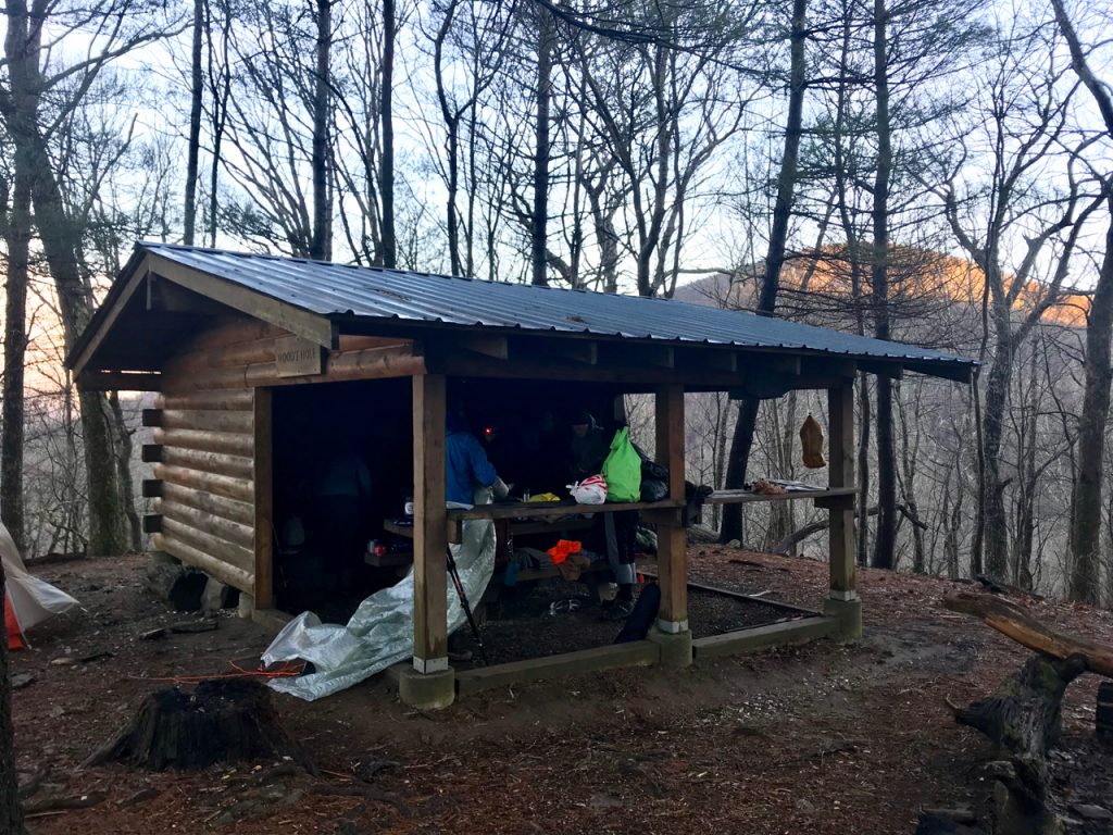
STOVER CREEK SHELTER
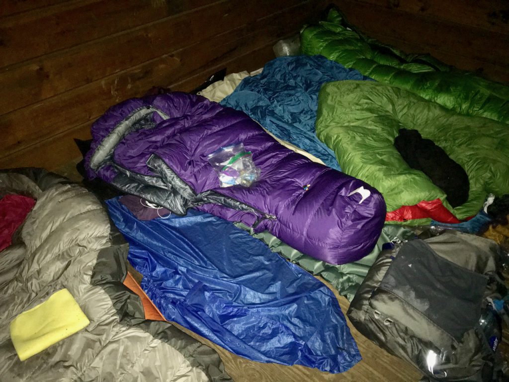
The start of the AT presented a visible change in the way the trail looked. More rhododendron, laurel…green. My stop for the night would be Stover Creek Shelter. As I skipped over the streams and heard the rain pounding on my umbrella, happiness filled me. The shelter materialized through the fog and I could see several people already there eating dinner. Several guys had set up tarps outside the shelter and one other woman and I would have the entire place to ourselves. Perfect! We talked a bit, but all of us were tired after the Approach, so we ate, set up gear, and fell into bed around 7 pm.
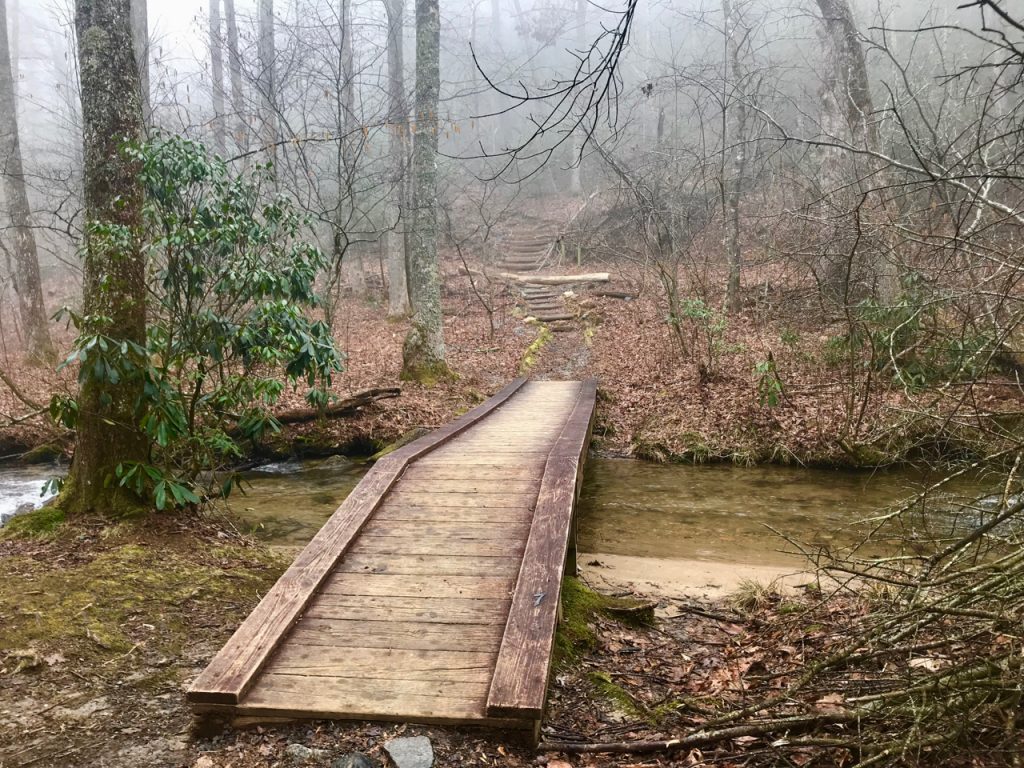
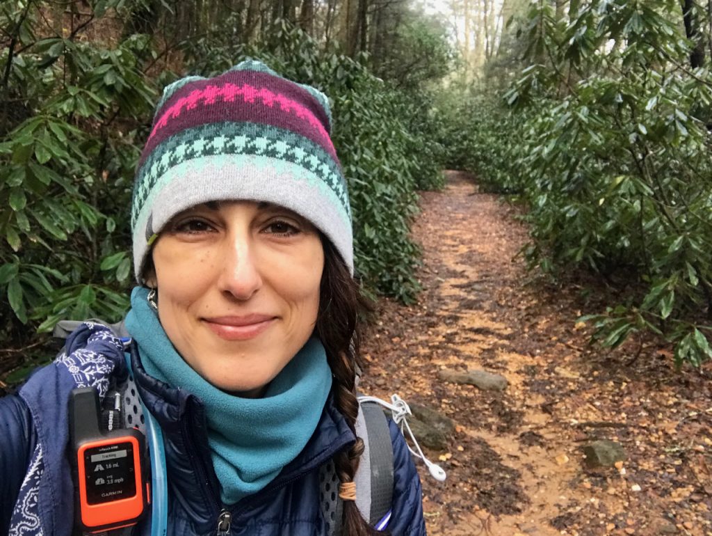
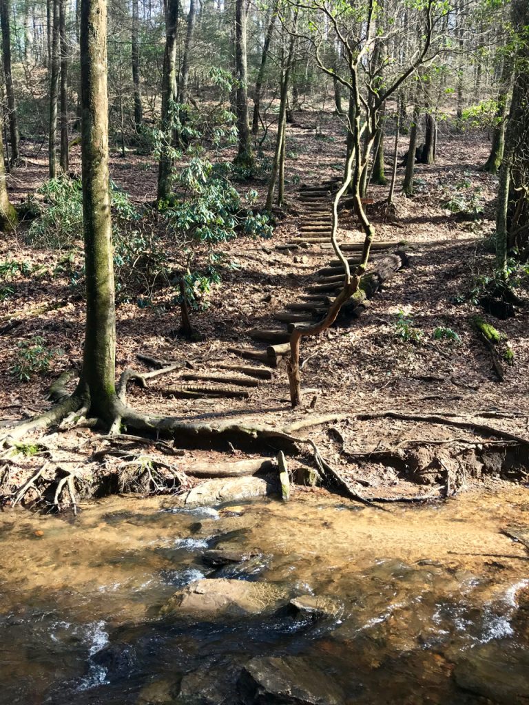
The next morning everyone packed up and headed out at different times. I used the privy, got myself situated, unpacked and repacked my food bag, made sure I wasn’t leaving anything behind, and set off into the mist. The hemlock forests and thick rhododendrons were a welcome sight after the brown of the Approach Trail. Streams were heavy with rain and flowed freely. Bridges provided safe passage.
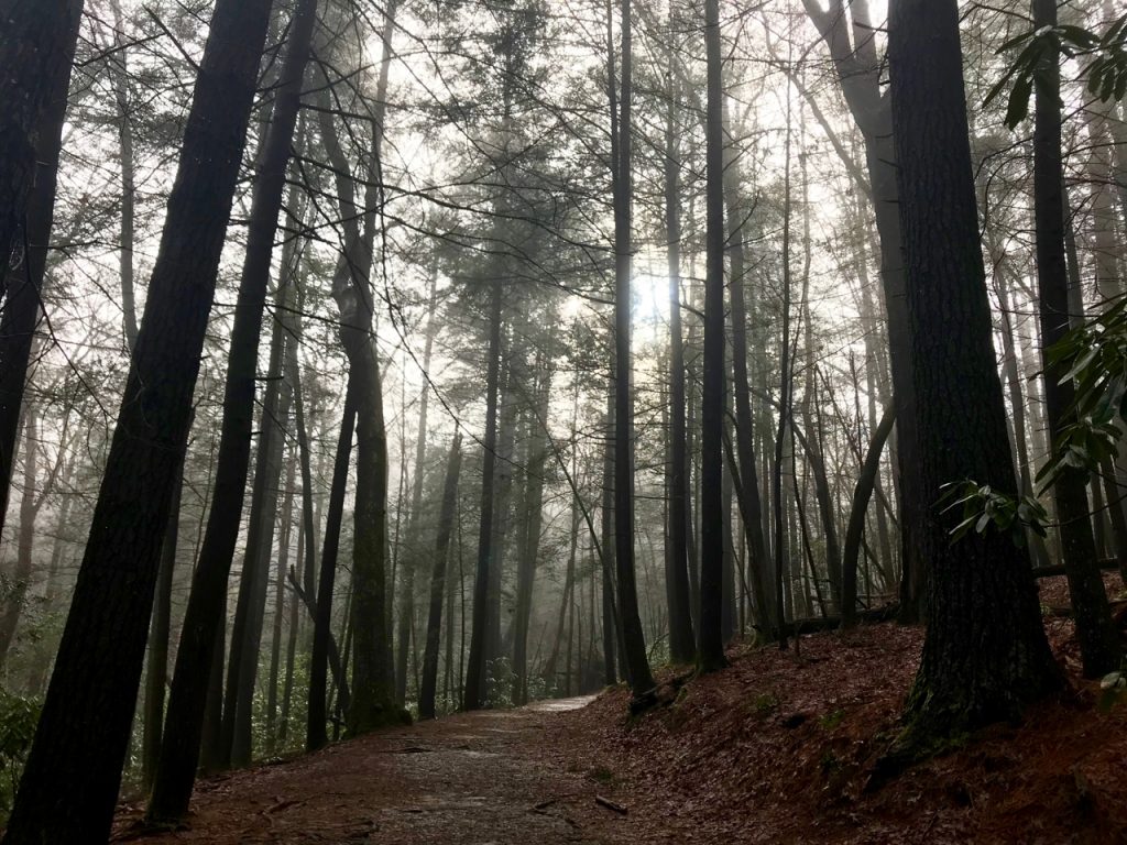
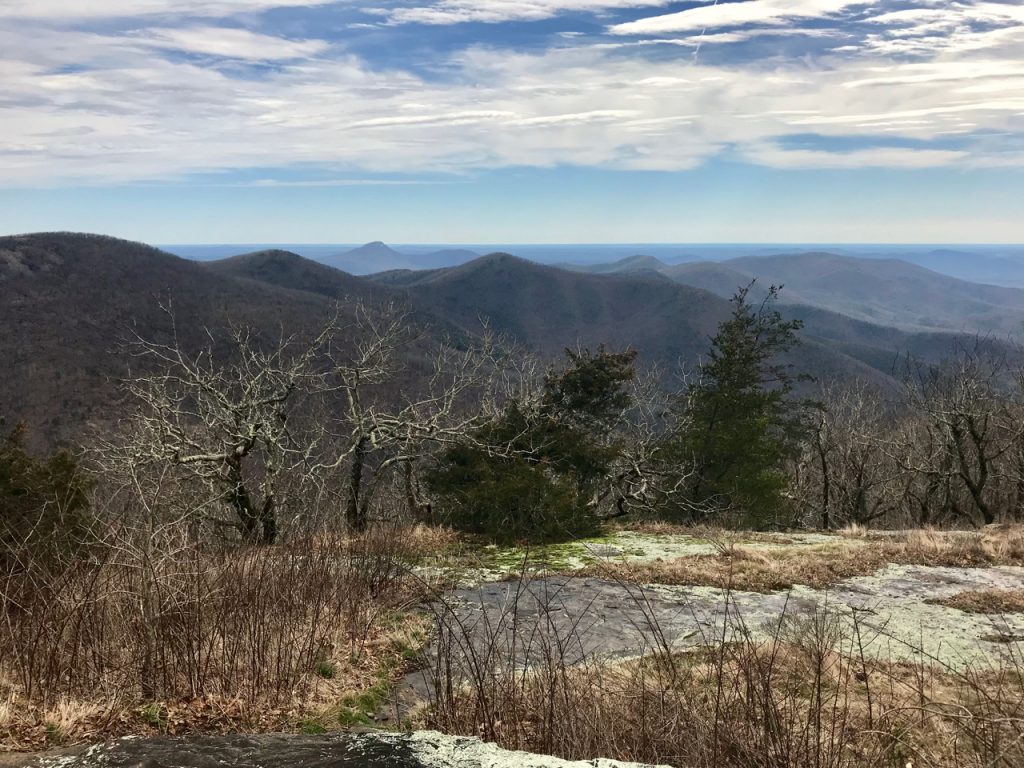
The morning brightened up as the miles wore on and soon enough the sun was shining! There is nothing more glorious than a sunny day following a really tough one in the rain. Trees were silhouetted by deep blue sky and dark mountain curves could be seen in the distance as clouds made their way across. This was the first day I became conscious of the mountains beneath my feet. When I hike in the Smokies, there is usually the goal of a particular mountaintop or location, and a steady 3,000 foot climb to get there. In Georgia, the distance between a starting point and an endpoint is filled with the ascent and descent of every mountain in between. Some refer to the trail as a roller coaster or PUDs (pointless ups and downs). Yes.
If there is a “gap” on the map, this means you will climb a mountain, then descend into the gap, then climb another mountain out of the gap. This is your new normal. Climbing each mountain will mean you go up until you think you can’t possibly go any higher, then you round a bend and the trail continues skyward. Music was my saving grace in these moments. There are plenty who think that listening to music takes away from the experience of being in nature. I disagree. I can experience it with both, and need the extra ounce of motivation to keep my pace moving quickly.
GOOCH MOUNTAIN SHELTER
The destination for the second day was Gooch Mountain Shelter, a spacious, double platform shelter with many tent sites surrounding it. When I arrived there were already quite a few people. Several had claimed spots in the shelter and I immediately decided to tent camp. I needed the privacy and wanted to have my own space away from everyone. Talk around the picnic table turned to the weather, gear, where folks were from. I was the only section hiker. Part of me felt like I didn’t deserve to be there as much as those who were thru hiking, and I had to constantly fight this feeling. I was hiking faster and farther than some of these folks, and my gear was fine-tuned and lightweight. I was prepared. I deserve to be here as much as anyone else. I belong. I belong. I belong.
That night I could hear the rain in my tent and knew this would mean packing up wet gear in the morning, but having my own space was worth its weight in gold. Introverting is a necessity. I learned later that a couple of snorers kept the rest of the shelter awake that night, and I was thankful for the sleep I was able to get. In the morning, I choked down some peanut butter crackers before packing up my tent with freezing hands that soon turned red and painful before going numb. The rain was still coming down softly, so I lashed the umbrella to my backpack, wore my rain kilt and rain jacket, and set out looking like a homeless bag lady.
HIKING TO WOODS HOLE SHELTER
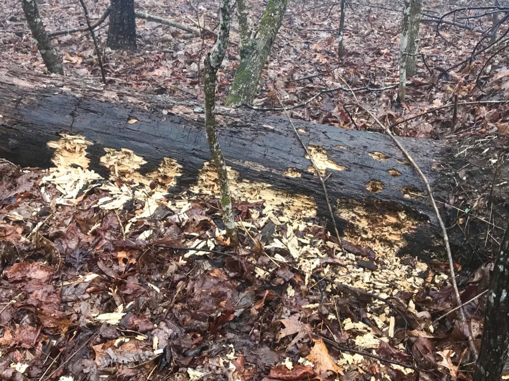
The goal today was the Woods Hole Shelter. The wind from the east was FIERCE, constantly blowing, trees creaking against each other, rain driving sideways at times. My pace was quick and I adjusted the umbrella to shield myself from the wind, raising and lowering it on the uphill/downhill, shifting it to the side when the wind picked up. The vision of a shelter where I could get warm burned in my brain and drove me on. I thought about resilience and how days like this only make a person stronger. Staying positive in the middle of miserable conditions only helps a body press on. Negativity accomplishes nothing in moments like this. I was not alone out there. Evidence of bears searching for late winter snacks were evident on logs throughout the forest.
I stopped beneath some giant boulders to eat lunch, hoping they would shield me from the gusts. Sitting in the middle of the woods completely alone, while wind and rain whip madly about was a new concept for me. Every time I stopped the cold immediately began to creep into my bones. Moving was the only way to stay warm. I quickly ate as much as I could, jumped back up, and was claimed again by the air’s strength.
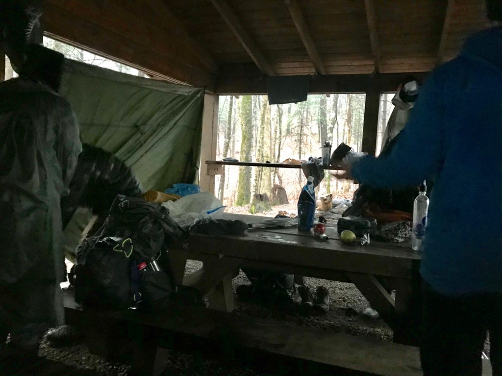
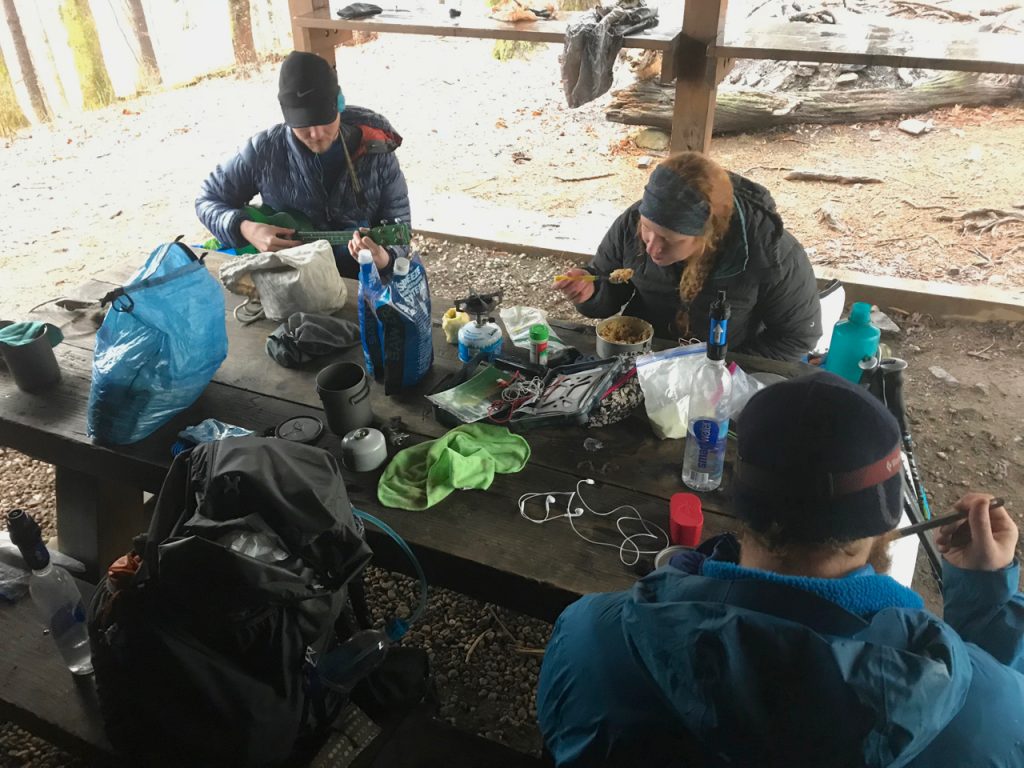
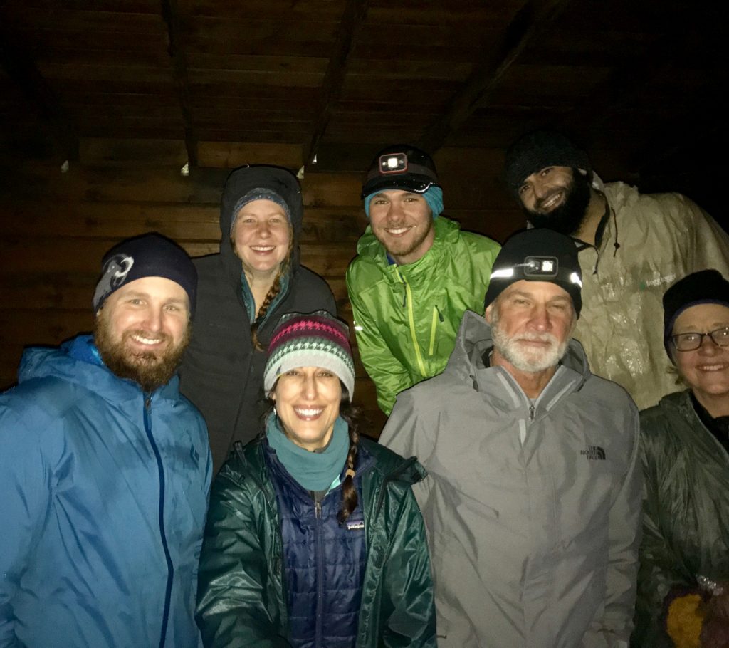
A small sign saying “SHELTER” emerged from the fog and I nearly ran the .4 miles to the tiny structure that would be my home for the night. Two men from the previous night were already there and we were talking about the cold and rain that were supposed to get worse. Another hiker arrived and decided to set up a tent, then another, then two more. Five of us would sleep on the platform of the shelter and one would sleep on the picnic table, also inside. The wind continued howling and everyone worked to string up tarps over the openings to shield us from the elements and provide warmth.
TRAIL MAGIC!
Soon we noticed another hiker, someone unfamiliar, heading down the trail toward us. He’d climbed up and over Blood Mountain from the difficult side and had come to bring fresh fruit and candy. A former thru-hiker from 2018, trail name Dine and Dash, played a beautiful song on ukulele while we ate dinner and tried to keep warm. I’ve heard many stories of trail magic, but have never experienced it myself. The fact that another hiker would come out in this weather just to bring smiles and fruit to those who’d just gotten on trail really touched my heart. After we’d asked him lots of questions about his thru hike, he went back into the weather to head home for the night. I keep thinking about him, feeling thankful that we met. I don’t think I’ll ever forget his kindness. Something as simple as an apple and a song can turn a hard day into a blessed one.
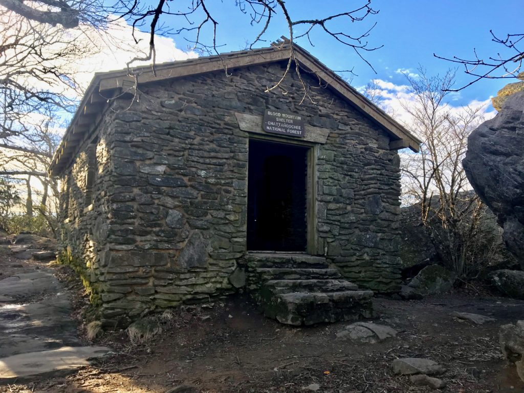
BLOOD MOUNTAIN
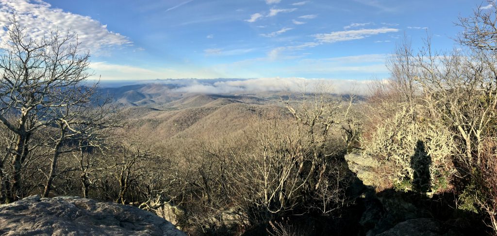
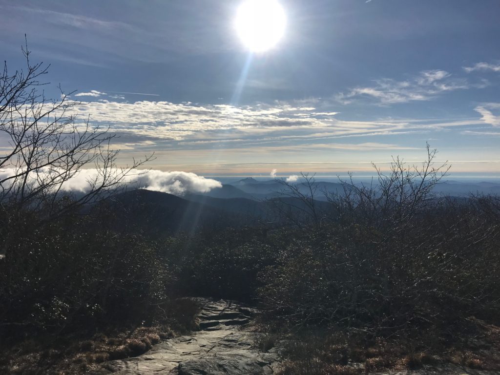
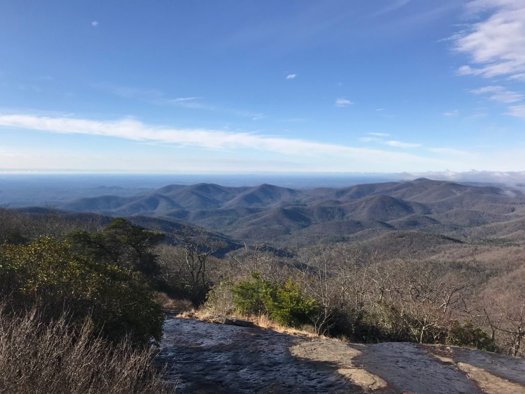
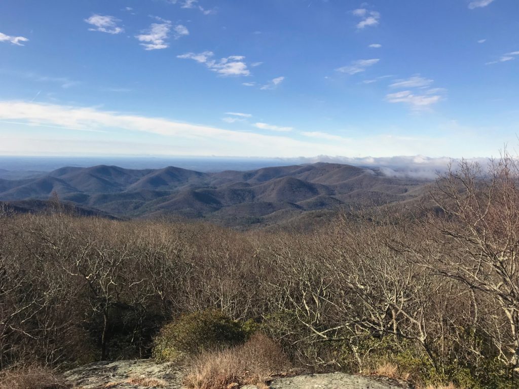
The night was cold and I didn’t sleep very much as the rain pounded on the tin roof of the shelter. We all woke up at the same time and frantically packed our gear, wanting to get moving before the cold set into our bones. When we stepped out from behind the tarps, blue sky appeared and pink clouds were sitting atop peaks that we could see through the trees. It was going to be a clear day!!! We’d get views on Blood Mountain!
The highest peak on the GA section of the AT did not end up having the worst climb. My muscles were tired, but imagining the views from the top kept me going. They did not disappoint!
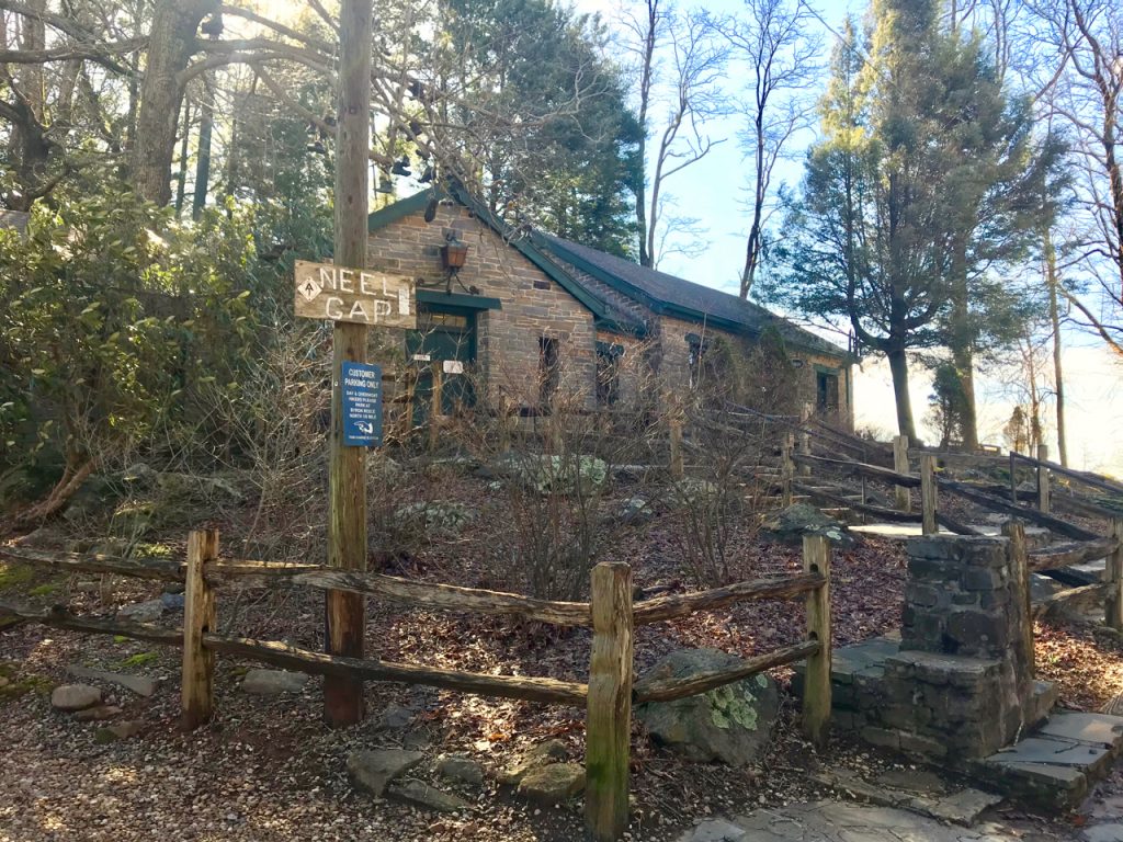
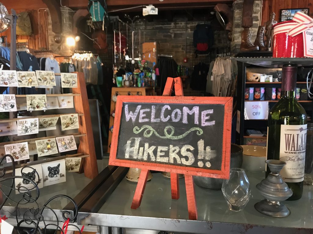
NEELS GAP – MOUNTAIN CROSSINGS
Leaving the mountain was hard. I wanted to stay and enjoy the hard-earned vistas, but Neels Gap was calling. The Mountain Crossings outfitter store sits right on the AT and is a welcome stop for hikers who want a shower, resupply, or gear upgrades. They make a ton of money helping hikers trade out heavy gear and offer a free pack shakedown to help eliminate unnecessary items. The day we were there the showers weren’t working, so those who had been planning to stay there decided to head on. I bought a t-shirt, a sticker, and Reese’s Peanut Butter Cups.
Neels Gap also has the distinction of being the spot where one third of thru hikers quit. The fact that I’d made it here and was planning to continue felt SO AMAZING. Another milestone. Another reminder that maybe I’m stronger than I think I am sometimes. Even though today was my last day on trail for this section, I was continuing on another 7.1 miles to Hogpen Gap where I would meet a shuttle driver who would take me back to my car at Amicalola. The climb out of Neels Gap seemed to go on forever, but food and candy was giving me the extra boost needed to get to the top.
TO HOGPEN GAP
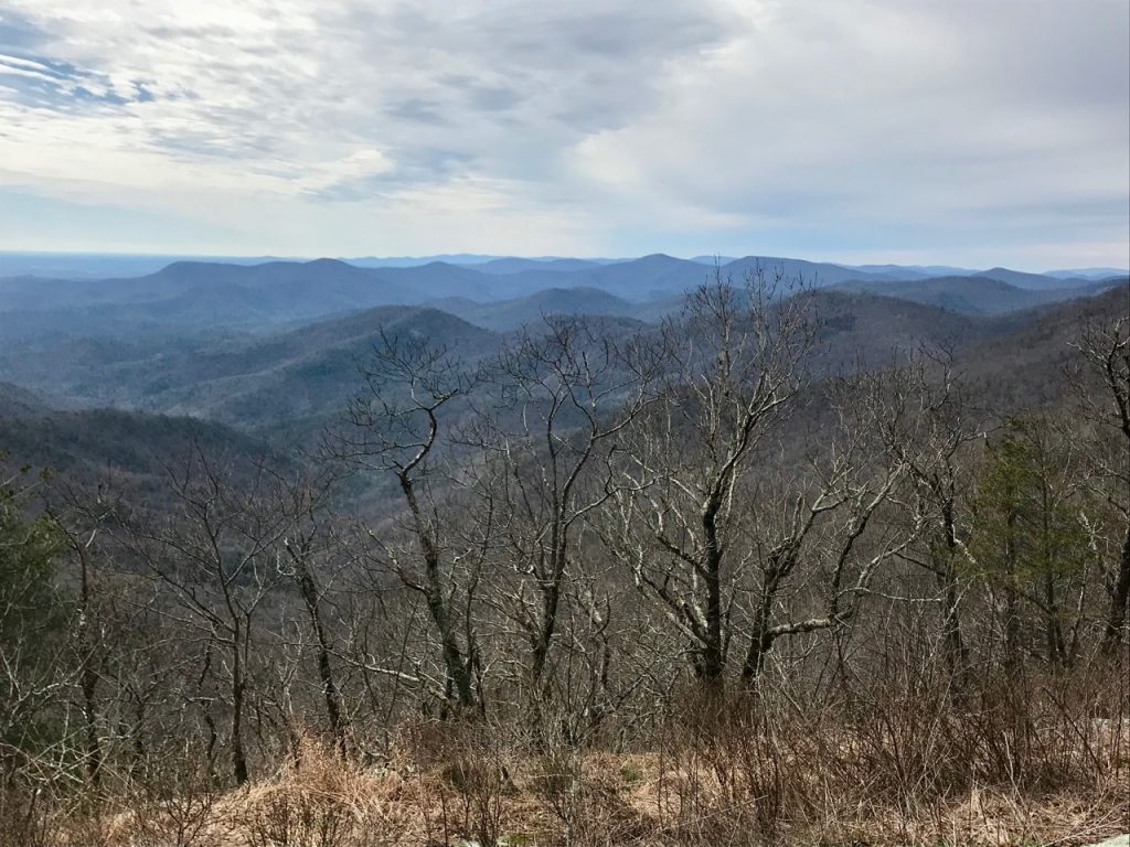
Once again, thankful the sun was shining! This ended up being a gorgeous section of trail, traversing ridge lines, providing views through the trees of mountains on all sides. There are several places to stop and take pictures or camp along the way. I’d set a time to meet my driver and felt compelled to press on as quickly as I could, stopping briefly to breathe and absorb the beauty of each view before dashing on.
There are still several climbs along the way here, but in the last 1.5 miles when I started descending, I was sure I was heading into Hogpen Gap. As I neared the bottom of a very steep hill, I looked ahead to see a white blaze on the other side of a small parking lot nestled below another enormous hill directly in front of me. SHIT! You have to be kidding me!!! I was dying. I couldn’t believe this. I’d been hiking as quickly as I could, thinking I was close to the end, but here I was faced with another ridiculous climb. I swore, ate some more candy and started telling myself, “I can do this. I can DO this!” Well, I don’t know if it was in my head or not, but the climb out of Whitley Gap felt like the hardest one I’d done in the four days I’d been out so far. There are a ton of switchbacks that keep going until you think you’re going to die. I had to stop at the end of every one, breathe, and force myself to continue. So close to the end. SO CLOSE! UGH!! Don’t let anyone tell you this is isn’t hard. As awesome as it is to be out in the woods, walking along the AT, it is so hard at some points.
Finally, I made it to the top, raced along the summit, and navigated the descent as nimbly as possible until I could see the parking lot where my driver was waiting. Seeing him there, knowing I’d accomplished the goal of this first section, brought so much happiness. This is only the beginning.
When we got back to Amicalola Falls, the man who drove me kindly offered to take some pictures by the beginning of the other Approach since I’d missed it when I started. He really was the sweetest man, and I loved talking with him on the ride back.
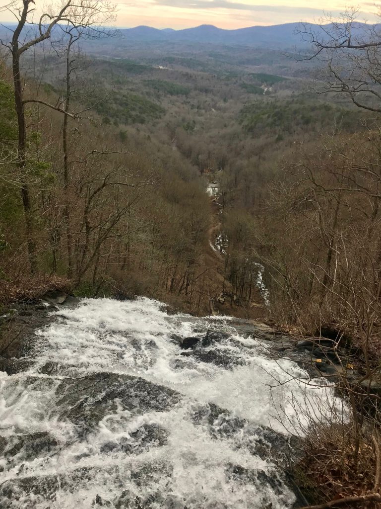
When we were done I headed up to the top of the falls to take in the view that was obscured by fog a few days before. Magnificent. If so much beauty exists at the start, what must the rest of the way be like?
Related posts:
/appalachian-trail-shakedown/
/10415-2/